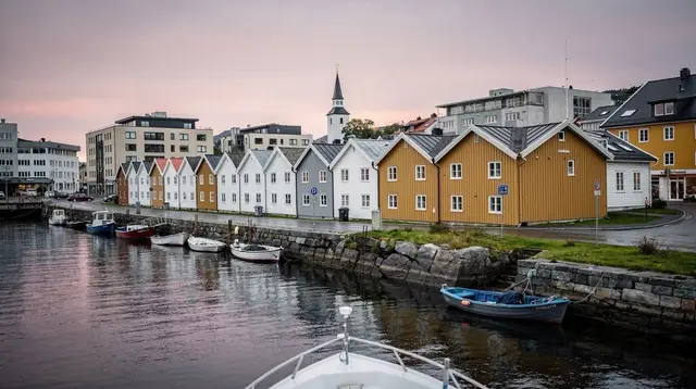
Explore Stavanger & Rogaland by area
Six areas worth building a Stavanger trip around, from the city itself and the Lysefjord's cliffs to the Jæren beaches, the inner fjords of Ryfylke, the Viking coast around Haugesund, and the quieter Dalane coast to the south.
Must-visit areas
The areas every first-time visitor should build a trip around — Stavanger itself, the Lysefjord with Preikestolen and Kjeragbolten, and Sandnes and Haugesund as the region's other two cities.

Frafjord: Gateway to Månafossen
Frafjord is the trailhead village for Månafossen, Rogaland's tallest waterfall. Here's how to get there, when to go, and what else to do nearby.

Haugesund: Gateway to Karmøy and Norway's Viking Coast
Haugesund is the Viking-coast base near Stavanger: boat trips, day trips to Karmøy and Avaldsnes, and an easy harbour town to explore.

Jæren: The Sandy Coast That Breaks Norway's Fjord Rule
Jæren's sandy beaches near Stavanger are Norway's exception to the fjords — dunes, surf and flat farmland instead of cliffs.
2 guides →
Kjeragbolten & Kjerag: The Boulder Hike Above Lysefjord
A serious 10-12 km hike to the boulder at Kjeragbolten (984 m) above Lysefjord: chained sections, real exposure, and a road that shuts each winter.
14 guides →
Lysefjord: How to See Norway's Fjord Without a Hike
The Lysefjord by boat, road or viewpoint: 42km of water, 1,000m walls, and how to see it without committing to a full-day hike.
14 guides →
Månafossen Waterfall
Månafossen drops 92 m above Frafjord in Ryfylke — how to hike to Rogaland's tallest waterfall, what it costs, and when to go.

Preikestolen: The Hike to Pulpit Rock
A practical guide to hiking Preikestolen: distance, elevation, parking, crowds, and how season changes the trail above the Lysefjord.
14 guides →
Sandnes: A Second Base Beside Stavanger
Sandnes forms half of Norway's 4th-largest urban area with Stavanger — here's what it offers as a base, and what it doesn't.
2 guides →
Stavanger
Stavanger travel guide: neighbourhoods, Sola airport transfers, climate, budget in kroner, and how to reach the Lysefjord and Rogaland.
9 guides →More to explore
Areas for a second trip or a longer first one — the Jæren coast and its sandy beaches, the inner fjords and waterfalls of Ryfylke, and the Viking sites around Haugesund and Karmøy.

Avaldsnes & the Nordvegen Viking Farm
Avaldsnes on Karmøy: a reconstructed Viking farm and a centuries-old royal site on Norway's Viking Age shipping lane, near Haugesund.

Dalsnuten: The Short Hike Above Sandnes and Gandsfjorden
Dalsnuten hike guide: distance, time and difficulty for this short Sandnes viewpoint hike, and how it compares to Preikestolen and Kjerag.
2 guides →
Egersund: A Base on the Dalane Coast
Egersund as a base on Rogaland's Dalane coast: distances from Stavanger, what's in town, and why Flekkefjord isn't the same stop.

Flekkefjord and Hollenderbyen: A Coastal Detour South of Stavanger
Flekkefjord and its historic Hollenderbyen quarter on Norway's Dalane coast: what to see, when to go, and how to get there from Stavanger.

Flor og Fjære: The Island Garden Off Stavanger
Flor og Fjære is a private island garden near Stavanger, reached by boat. Here's when to go, what it costs, and how it differs from a Lysefjord cruise.
9 guides →
Flørli & the 4,444 Steps
Flørli's 4,444-step wooden staircase on the Lysefjord: history, how hard the climb is, boat access, and when to go.
14 guides →
Gamle Stavanger
Gamle Stavanger is a free, still-inhabited old town of 170 white wooden houses near Vågen harbour — the largest preserved in Northern Europe.
9 guides →
Karmøy & Skudeneshavn: The Viking Coast North of Stavanger
Karmøy island and the wooden town of Skudeneshavn, Norway's Viking-era coast north of Stavanger — beyond Avaldsnes.

Norwegian Petroleum Museum
The Norwegian Petroleum Museum tells how the 1969 Ekofisk discovery turned Stavanger into Norway's oil capital, in a platform-shaped building.
9 guides →
Orre & Borestranden: Jæren's Wild Sand Beaches
Orre and Borestranden are Jæren's windswept sand beaches near Stavanger — built for walking and surfing, not for swimming in warm water.
2 guides →
Øvre Holmegate: Stavanger's Colourful Street
Øvre Holmegate is Stavanger's rainbow-painted shopping street: cafes, boutiques and a short, easy add-on to a city-centre walk.
9 guides →
Ryfylke: Norway's Inner Fjord Country
Ryfylke is Rogaland's inland fjord region, reached from Stavanger via the world's longest subsea tunnel — waterfalls, kayaking and quiet roads.

Sola, Tananger & Solastranden
Sola, Tananger and Solastranden: Stavanger's sandy coastal edge near the airport, with beach walks, a fishing harbour and fjord tours nearby.
9 guides →
Stavanger Cathedral
Stavanger Cathedral, consecrated around 1125, is Norway's only medieval cathedral still standing without a major rebuild.
9 guides →
Stavanger's Street Art and the Nuart Festival
Stavanger's street art scene and the Nuart festival, running since 2001 — one of Europe's longest-established urban art events.
9 guides →
Sverd i Fjell: Three Bronze Swords at Hafrsfjord
Sverd i Fjell's three bronze swords at Hafrsfjord, near Stavanger: what they mark, how to get there, and what's legend versus history.
9 guides →
Utstein Kloster: A Medieval Monastery on Mosterøy Island
A historic monastic site on Mosterøy island near Stavanger — one of Norway's best-preserved medieval religious buildings, and a quiet half-day trip.
9 guides →
Viking House Stavanger: The VR Sagas Experience
Viking House Stavanger's VR saga experience: what you see, how long it takes, ticket costs, and why it's not an archaeological site.
9 guides →Off the beaten path

Bryne: Farmland Heart of Jæren
Bryne is Jæren's inland farm town: grain fields, greenhouses and dairy country, a quiet working contrast to the sandy coast nearby.
2 guides →
Byrkjedal & Hunnedalen: Ryfylke's Inland Scenic Drive
Byrkjedal and the Hunnedalen valley form a quiet mountain drive through inner Ryfylke, connecting Stavanger's fjord country to Sirdal.

Forsand and Lauvvik: The Quiet Way onto the Lysefjord
Forsand and Lauvvik are Stavanger's quieter alternative harbours for Lysefjord boat trips and RIB safaris, close to Preikestolen without the queues.
14 guides →
Gloppedalsura: Norway's Largest Boulder Field on Foot
How to walk Gloppedalsura, a vast rockslide boulder field in inner Ryfylke — geology, route, timing and what to bring.

Himakånå: The 'Trolltunga of Haugesund'
Himakånå is a striking rock ledge near Haugesund, nicknamed after Trolltunga — quieter, closer, and far less crowded than the original.

Jørpeland and Strand: A Quiet Base for Preikestolen
Jørpeland and Strand sit across the fjord from Preikestolen's trailhead — a practical, quieter alternative to basing yourself in Stavanger.
14 guides →
Jøssingfjord & the Magma Geopark
A narrow fjord at the southern tip of Dalane, set in Rogaland's Magma Geopark landscape.

Kvassheim and Obrestad Lighthouses
Two working lighthouses on the Jæren coast road, 45 minutes from Stavanger — sand, wind and a very different Norway.
2 guides →
Lysebotn & the Lysevegen Hairpins
Lysebotn and the Lysevegen hairpin road at the end of the Lysefjord: winter closures, driving times and why it is the only way to Kjerag.
14 guides →
Sirdal: Rogaland's Winter Mountains
Sirdal is inner Ryfylke's winter face: skiing and snow within reach of Stavanger, but only for part of the year. Here's when it works.

Skogsprett Adventure Park: Treetop Courses Near Sandnes
Skogsprett is a secured treetop ropes course near Sandnes, close to Stavanger — a family adventure day out, not a mountain hike.
2 guides →
Stavanger Airport (SVG): The Complete Transfer Guide
How to get from Stavanger Airport to the city: bus, taxi and car hire times, costs and schedules, 14 km from the centre.
9 guides →
Vågen Harbour & the Stavanger Fish Market
Vågen is Stavanger's working harbour: fish market stalls, Gamle Stavanger across the water, and the dock for Lysefjord boat trips.
9 guides →
Valbergtårnet & the Old Watchtower View
Valbergtårnet is Stavanger's old fire watchtower, a quick stop for harbour views on a city-centre walk — not a headline sight on its own.
9 guides →
Vitenfabrikken Sandnes: Rainy-Day Science Centre
Vitenfabrikken is Sandnes' indoor science centre - hands-on exhibits for families on rainy days, a short trip from Stavanger and the Jæren coast.
2 guides →Good to know about Stavanger and its surroundings
97°N, this is the mild, wet south, not the Arctic Norway of the midnight sun. Stavanger, Sola & the city fjords covers the city itself: Gamle Stavanger's roughly 170 white wooden houses from the 18th and 19th centuries, the colourful shops of Øvre Holmegate, Stavanger Cathedral, consecrated around 1125, the Norwegian Petroleum Museum, opened in 1999 on the harbour, and Sverd i Fjell, three bronze swords planted at Hafrsfjord in 1983 to mark the battle fought there in 872.
Lysefjord, Preikestolen & Kjeragbolten groups the fjord itself — around 42 km long, with walls over 1,000 m in places — with its two defining hikes: Preikestolen, a 604 m plateau with no safety railing, and Kjeragbolten, a boulder wedged at around 984 m and reached past three chained sections, plus Flørli's 4,444-step staircase, the longest wooden staircase in the world. Sandnes, Jæren & the North Sea beaches covers the long sandy coastline at Orre, Borestranden and Kvassheim, which looks nothing like the fjord country further north.
Ryfylke, Frafjord & the inner fjords is built around the 92 m Månafossen waterfall and the Ryfylketunnelen, a subsea road tunnel opened in 2019 that reaches nearly 292 m below sea level. Haugesund, Karmøy & the Viking coast covers Avaldsnes and the Viking history around Karmøy island, and Egersund, Flekkefjord & the Dalane coast closes the hub with the fishing towns of the south. The road to Kjerag, via Lysebotn, closes each winter with the snow, which shapes when several of these regions are realistically reachable — each destination page below sets out what's actually there rather than a generic description of "Norway".
Frequently asked questions about Stavanger and its surroundings
What are the six regions on this hub?
Stavanger, Sola & the city fjords; Lysefjord, Preikestolen & Kjeragbolten; Sandnes, Jæren & the North Sea beaches; Ryfylke, Frafjord & the inner fjords; Haugesund, Karmøy & the Viking coast; and Egersund, Flekkefjord & the Dalane coast.
Is Stavanger in Arctic Norway?
No — at 58.97°N it sits in the mild, wet south-west, with no reliable midnight sun or northern lights. Those belong to northern Norway, much further away.
What's the difference between Preikestolen and Kjeragbolten?
Preikestolen is a 604 m plateau with no railing but a well-marked trail; Kjeragbolten is a harder, more exposed hike past three chained sections to a boulder wedged at around 984 m, with fatal falls on record.
Can I reach Ryfylke without a ferry?
Yes — the Ryfylketunnelen, opened in 2019, connects Stavanger to the Ryfylke region by road, reaching nearly 292 m below sea level along the way.
Why might Kjerag be closed when I visit?
The Lysebotn road that leads to the Kjerag trailhead closes in winter because of snow, which cuts off access for a large part of the year.
tours.falls-viewpoints
Verified deep-linked GetYourGuide tours. Book through these links and we earn a small commission at no cost to you.
GetYourGuide does not provide a product photo for this activity — the image shows the meeting point, photographed by us.