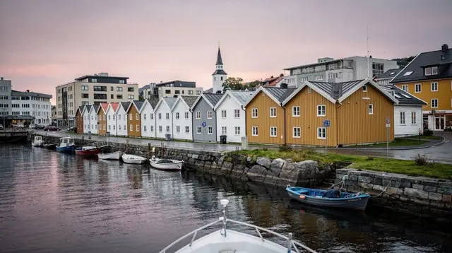
A hill for an ordinary morning, not a headline hike
Every guide to this part of Norway leads with the same two names: Preikestolen and Kjeragbolten. Both deserve the attention — a 604 m plateau over the Lysefjord, a boulder wedged above a thousand-metre drop, chains, crowds, hours on the trail. Dalsnuten is not trying to be either of those. It is a granite hilltop directly above Sandnes, close enough to reach without a rental car, short enough to finish before lunch, and open enough at the top to give you a genuine, wide view over the city, Gandsfjorden and the rolling farmland of Jæren behind it.
If you have a spare morning or afternoon in the Stavanger area and don’t want to commit a full day to a fjord hike, or if you’re travelling with children, older relatives, or simply without your own transport, Dalsnuten is the hike locals actually do on a weeknight after work. That’s the honest pitch: not a bucket-list summit, a genuinely pleasant one.
Where Dalsnuten is and how to get there
Dalsnuten sits in the hills east of Sandnes, part of the same ridge system that separates the city from the inland lakes and farmland toward Bryne. From central Stavanger, the trailhead is roughly 25-30 minutes away by car, most of it spent getting through and past Sandnes itself before a short stretch up toward the parking area at the foot of the hill.
If you’re relying on public transport, Sandnes is well served from Stavanger, and local Kolumbus buses run into the residential areas at the base of the hill — closer than either Preikestolen or Kjerag, both of which require a car or an organised shuttle to reach the trailhead at all. That difference matters more than it sounds: this is one of the few proper hikes in the region genuinely reachable without your own wheels, which is why it turns up so often in advice for travellers without a car.
Parking at the main trailhead is limited, especially on clear summer evenings and weekends, when half of Sandnes seems to have the same idea. Arrive early or accept a short extra walk from a side street if the closest spaces are full.
The trail itself
Dalsnuten’s summit sits at a modest elevation compared to the giants further into the Lysefjord — this is a hill, not a mountain, and the numbers reflect it. The round trip on the main marked route runs roughly 6-8 km depending on exactly where you park, with a total climb in the region of 300 vertical metres. Most people cover the whole thing, up and down, in two to three hours at an unhurried pace, including time at the top.
The path is well maintained and clearly marked with the red “T” markers used across Norwegian hiking trails, alternating between forest track, open heath and stretches of bare granite slab near the summit — the same pale rock that shows up across this part of Rogaland, worn smooth in places by generations of boots. There’s a reasonable amount of uneven footing and a steady, sustained climb rather than a flat stroll, so trainers are fine in dry summer conditions but proper shoes with grip make the descent noticeably easier, particularly on the smooth rock sections when they’re damp — which, given the region’s rainfall, is often.
None of this involves the terrain, chains or drop-offs that define Kjeragbolten, and none of it takes anywhere near the four to five hours that a return trip to Preikestolen typically does. If you’ve read up on either of those hikes and are wondering whether Dalsnuten is a smaller version of the same thing, it isn’t: there’s no exposed plateau edge, no chained scramble, and no comparable fall risk. It’s a straightforward, if properly uphill, walk to a rocky summit with a view.
What you get at the top
The reward for the climb is a broad, open outlook rather than a single dramatic drop. From Dalsnuten’s summit you look down over Sandnes and the waters of Gandsfjorden, out toward Stavanger in the distance, and inland across the patchwork of lakes, farmland and low hills that make up much of Jæren — a genuinely different landscape from the fjord walls further east, and a useful reminder that this region isn’t only fjords and cliffs. On a clear evening, especially in the hour or two before sunset, the light across the water and the farmland makes this one of the more photographed lesser-known viewpoints in the area, popular enough with residents that you’ll rarely be alone up there on a fine day.
There’s no facility at the summit — no café, no shelter beyond the rock itself — so this is a bring-your-own-thermos kind of stop rather than a destination with services. Pack accordingly, the same as you would for any hike in this climate: a shell against wind and the ever-present chance of rain, water, and something to eat at the top.
Difficulty, honestly
It’s worth being direct about where Dalsnuten sits on the region’s difficulty scale, because it’s easy for “short hike near the city” to get rounded up or down in either direction.
| Hike | Round trip | Typical time | Elevation gain | Exposure |
|---|---|---|---|---|
| Dalsnuten | ~6-8 km | 2-3 hours | ~300 m | None — no chains, no cliff edge |
| Preikestolen | ~8 km | 4-5 hours | ~350 m | Unfenced plateau edge at the top |
| Kjeragbolten | ~10-12 km | 6-8 hours | Steep, chained sections | Serious — chains, real fall risk |
Dalsnuten is genuinely the easiest of the three by every measure that matters: shorter, faster, less elevation, and no exposed terrain at any point. It’s still a real hike with a real climb — not a paved path, and not something to attempt in trainers with no water on a hot day — but it doesn’t ask for the fitness, time commitment or nerve that Kjeragbolten does, and it doesn’t carry Preikestolen’s crowds or length either. If you’re building a trip and trying to work out which hikes fit which day, Dalsnuten is the one to slot into a half day with something else, not the one to build a whole day’s itinerary around.
Who this hike actually suits
Dalsnuten’s real audience is narrower than “everyone,” and it’s worth naming it plainly. It works well for:
- Anyone based in or passing through Sandnes who wants a proper hike without arranging transport to the Lysefjord trailheads.
- Families with children old enough for a sustained uphill walk but not ready for Preikestolen’s length or Kjerag’s chains.
- Visitors without a car doing a run of shorter, transit-reachable outings around Stavanger and Sandnes.
- People short on time — a free morning or a few hours after checking out of a hotel — who still want to get above the city rather than stay in it.
- Hikers pacing a longer trip, using Dalsnuten as a warm-up the day before or a lighter outing the day after tackling one of the bigger fjord hikes.
It suits these groups better than it suits anyone chasing a specific “big” Norwegian hiking photo — for that, the Lysefjord hikes remain the ones worth the longer day.
Pairing Dalsnuten with the rest of a Sandnes day
Because the trailhead sits right on Sandnes’ doorstep, Dalsnuten pairs naturally with everything else the town and the fjord in front of it offer, rather than requiring a dedicated day of its own. A hike in the morning, while the light and legs are both fresh, leaves the afternoon open for the water.
Sandnes is also one of the departure points for fjord trips into the Lysefjord itself, which is worth knowing if Dalsnuten is your warm-up rather than your main event for the day. A RIB boat tour into the Lysefjord departing from Sandnes covers, in a couple of hours on the water, the scale that Dalsnuten’s summit only hints at from a distance — the fjord walls, the waterfalls, the sense of depth that a hilltop view over the city doesn’t quite deliver.
For a steadier pace and a look at Preikestolen from below, a Lysefjord and Pulpit Rock boat tour from Sandnes works well as an afternoon plan after a morning on Dalsnuten.
If the hike leaves you wanting more trail rather than more water, Sandnes and Forsand are also common starting points for guided walking in the hills around the fjord — a locally guided hike in the hills around Preikestolen is a reasonable next step once Dalsnuten has confirmed you’re up for more distance and elevation than the short version offers.
For those without a car, a boat departure is also one of the more practical ways to see Preikestolen without arranging trailhead transport — the Lysefjord boat trip to Preikestolen from Forsand is a fjord-based alternative worth knowing about if the famous plateau is still on your list but the standard hike isn’t.
When to go
Dalsnuten is walkable for much of the year, but conditions swing more than the short distance suggests. May through September gives the most reliable footing: dry granite, longer daylight, and a summit that’s genuinely pleasant to linger on. Outside that window, the exposed rock sections near the top can turn slick with rain or icy in cold snaps, and the region’s rainfall is frequent rather than occasional, so checking a forecast the morning of your hike is worth the two minutes it takes.
Evening light in summer is arguably the best reason to go — long Nordic daylight means an after-work or after-dinner ascent still leaves the summit view lit well, which is part of why so many local hikers treat Dalsnuten as a routine rather than an event. A winter hike is possible on a clear, cold day with proper boots and some care on the rock, but it’s a different, more serious outing than the summer version, and not one to attempt underprepared.
What to bring
Nothing here calls for specialist gear, but the basics matter more than the short distance suggests, mostly because of the weather rather than the terrain:
- Sturdy shoes with real grip — trainers work in dry weather, hiking shoes work in everything
- A waterproof or windproof shell, regardless of the forecast
- Water and a snack — there’s nothing to buy on the trail or at the summit
- A layer for the top, since wind picks up noticeably once you’re above the treeline
- A phone or camera for the Gandsfjorden view, which is the actual point of the climb
For a fuller rundown that applies across the region’s hikes, big and small, the general guide to what to pack for hiking in Rogaland covers the same ground in more detail.
What Dalsnuten is not
It’s worth closing on the comparison this hike invites constantly, because getting it wrong sets the wrong expectations either way. Dalsnuten is not a smaller Preikestolen and not a gentler Kjeragbolten — it isn’t really the same category of hike at all. There’s no unfenced cliff edge to manage, no chained rock face, no multi-hour commitment, and no need for the level of fitness or nerve that those two hikes ask for.
If you came to this page looking for a lower-stakes version of the plateau or the boulder, this is that hike. If you came looking for the scale and drama that make Preikestolen and Kjeragbolten famous worldwide, this isn’t it, and no amount of good light at the summit will change that. Go into it knowing which trip you’re on, and Dalsnuten does exactly what it promises: a good, honest climb, a wide view, and an afternoon back in Sandnes with time to spare.
Dalsnuten hike questions people actually ask
How long does the Dalsnuten hike take?
Most hikers complete the round trip in two to three hours, including time at the summit, covering roughly 6-8 km with about 300 m of elevation gain depending on the exact starting point.
Is Dalsnuten suitable for children?
Yes, for children who can manage a sustained uphill walk on uneven ground for an hour or more each way. There are no exposed edges or technical sections, which makes it considerably more forgiving than Preikestolen or Kjeragbolten for a family outing.
Do I need a car to hike Dalsnuten?
No. The trailhead sits close to residential Sandnes and is reachable by local bus, which makes Dalsnuten one of the few proper hikes in the region genuinely practical without your own transport.
Is Dalsnuten as difficult as Kjeragbolten?
No, and it shouldn’t be treated as such. Kjeragbolten involves a much longer route, steep chained sections and real exposure near a roughly 1,000 m drop. Dalsnuten has none of that — it’s a shorter, unexposed hike to a rocky summit with a view.
What’s the best time of day to hike Dalsnuten?
Late afternoon into early evening in summer is popular for the light over Gandsfjorden and Sandnes, though the trail is walkable at any daylight hour from spring through autumn.
Is there parking at the trailhead?
Yes, but it’s limited and fills up on clear evenings and weekends. Arriving early or being prepared to park a short walk away is sensible in good weather.
Can Dalsnuten be combined with a fjord trip on the same day?
Yes — its trailhead is close enough to Sandnes’ harbour area that a morning hike followed by an afternoon fjord tour, or the reverse, is a realistic plan for one day.
Is Dalsnuten worth it if I’m short on time in Stavanger?
If you want a real summit view without dedicating half a day to Preikestolen or Kjerag, yes. It’s the region’s best option for a meaningful hike in two to three hours.