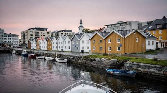
A mountain road, not a destination in the usual sense
Most people who reach Byrkjedal did not set out to see Byrkjedal. They are driving through it, on the road that climbs out of the coastal lowlands around Gjesdal and Ålgård and follows the Hunnedalen valley up into the mountains toward Sirdal and, eventually, the Setesdal valley further east. That is the honest way to describe this stretch of inner Ryfylke: a scenic drive that links two very different landscapes, rather than a single attraction with a car park and a ticket booth. If you are looking for a headline sight, you will not find one here. If you want to understand how quickly the coast around Stavanger gives way to bare granite and high plateaus, this is one of the best routes to do it on.
The valley takes its name from Hunnedalselva, the river that carved it, and the road running alongside it climbs steadily from farmland into increasingly stark mountain terrain. Byrkjedal itself is a small settlement roughly at the point where the valley opens out and the gradient eases before the final climb toward the Sirdal border. It has long served as a staging point for people crossing between Rogaland’s coast and the inland mountains, and that function has not really changed even though most traffic today is drivers and cyclists rather than the horse-drawn traffic of earlier centuries.
What the drive actually looks like
Leaving the Stavanger area, the character of the landscape changes in stages rather than all at once. Farmland and forest around Gjesdal give way to a narrower valley as the road follows the river upstream. The lower stretches of Hunnedalen are wooded and relatively gentle; the upper stretches are much more exposed, with bare rock faces, scattered boulder fields, and long views over a landscape with very little tree cover. By the time you approach the Sirdal border, you are firmly in mountain terrain, at an elevation and openness that feels disconnected from the fjord city you left less than two hours earlier.
This contrast is the main reason to make the drive at all. Stavanger and its immediate surroundings are shaped by the sea, by low farmland, and by the fjords that cut into the coast. Hunnedalen shows a completely different Rogaland: a county that also contains genuine high-mountain terrain, snow that lingers into early summer at altitude, and a starkness that has more in common with inland Norway than with the harbor towns most visitors associate with the region.
Along the way, the road passes close to Gloppedalsura, a dramatic boulder field left behind by a prehistoric rockslide, sitting right beside the road as a natural waypoint rather than a hike. It is worth a short stop if you are already driving this route, though it is really a single striking view rather than a place that needs a long visit — treat it as a five-to-ten-minute pause, not a destination to plan an afternoon around. Further along, the road continues toward Sirdal, a mountain municipality with its own hiking, skiing, and cabin culture that lies well beyond the scope of a Stavanger day trip but makes sense as a next stop if you are continuing inland rather than looping back to the coast.
Byrkjedal itself
The settlement of Byrkjedal is modest: a scattering of buildings around the point where the valley widens, historically tied to farming and to travelers moving between the coast and the mountains. Its best-known landmark is Byrkjedal Gjestegiveri, a historic guesthouse and gathering point that has operated in one form or another for generations and today functions as a restaurant, small hotel, and informal waypoint for people driving the Hunnedalen route. It is a sensible place to break the drive for a coffee or a meal, particularly if you are continuing on toward Sirdal or looping back through Ryfylke rather than returning directly to Stavanger.
Beyond the guesthouse, Byrkjedal does not offer a dense list of sights. That is not a flaw so much as an accurate description: this is a waypoint on a scenic route, and its value lies in the drive around it and the access it gives to the surrounding mountains, not in a cluster of paid attractions. If your itinerary is built around ticking off named sights, Byrkjedal will feel thin. If your itinerary has room for an unhurried mountain drive with genuine, uncrowded scenery, it earns its place.
How this fits with the rest of Ryfylke
Byrkjedal and Hunnedalen sit within the broader Ryfylke region, the inland fjord country northeast and east of Stavanger that also includes Frafjord, the Månafossen waterfall, and the Ryfylketunnelen connecting the region to the city without a ferry. Frafjord and Månafossen lie on a different branch of Ryfylke’s road network from Hunnedalen, so treat them as a separate leg of a Ryfylke day rather than an add-on to the Byrkjedal drive itself — trying to combine both in one day from Stavanger makes for a very long day behind the wheel.
If Ryfylke’s waterfalls and fjord scenery are the priority, Månafossen and Frafjord are the more efficient use of a single day; Hunnedalen suits travelers who have a car for longer, who are continuing inland toward Sirdal, or who specifically want mountain-plateau scenery rather than fjord views.
It is worth being direct about one common mix-up: Hunnedalen is not the same route as the road to Lysebotn. The Lysebotn road is a separate, far more dramatic mountain route south of the Lysefjord, built to reach the head of the fjord and famous for its hairpin turns and its role as the access point for Kjeragbolten. Hunnedalen runs through a different part of Rogaland entirely, connecting the coast near Gjesdal to Sirdal rather than descending to the Lysefjord. The two roads share a general character — both are narrow mountain routes through dramatic scenery — but they lead to entirely different places, and travelers occasionally research one while meaning the other. If your goal is Kjerag, you want the Lysebotn road, not this one.
Practical driving notes
A rental car is effectively required. There is no meaningful public transport along Hunnedalen, and the valley’s whole appeal is the flexibility to stop where you like, so a self-drive itinerary is the only realistic way to experience it. The road itself is paved and generally in good condition, but it is a mountain road: narrow in places, with limited overtaking opportunities and stretches without barriers, so allow more time than a map’s distance estimate suggests and drive with appropriate caution, particularly if you are used to wider roads.
Season matters more here than on most of the coastal routes around Stavanger. Snow can linger at altitude well into spring, and the upper stretches of the valley can be affected by winter conditions earlier and later in the year than the coast itself. Late May through September is the most reliable window for an untroubled drive with the scenery at its best; outside that period, check road conditions before setting out, since sections can be slippery, snow-covered, or in poor visibility even when Stavanger itself is experiencing mild, wet weather rather than snow.
Fuel up before leaving the Stavanger area. Facilities become sparser once you are in the valley, and Byrkjedal Gjestegiveri is really the only reliable stop for food along the route itself. Pack for changeable mountain weather regardless of the season — temperatures drop with elevation, and wind and rain can arrive quickly even on a day that starts clear and mild down at the coast.
| Consideration | What to expect |
|---|---|
| Vehicle needed | Rental car; no public transport serves the valley |
| Road surface | Paved throughout, narrow in stretches, limited overtaking |
| Best season | Late May to September |
| Fuel and food stops | Fuel up before departure; Byrkjedal Gjestegiveri is the main stop en route |
| Typical use | One leg of a longer Ryfylke or Sirdal-bound drive, not a standalone trip |
Where the fjord and mountain experiences actually are
Because Hunnedalen itself is a driving route rather than a hub of bookable activities, most of the organized experiences that pair naturally with a Ryfylke-focused trip are based around Frafjord and the fjords closer to the coast rather than in the valley itself. If you want to get onto the water before or after a day of mountain driving, a guided kayak or stand-up paddle outing on Frafjord gives a very different, waterline perspective on the same general region.
For a more physical day that combines a waterfall with some scrambling, a guided via ferrata and bouldering session at Månafossen is a reasonable pairing if your itinerary has room for both Ryfylke branches on different days.
Travelers who want the mountain perspective without driving themselves can also look at options closer to Stavanger. A helicopter flight over the Preikestolen plateau and surrounding fjord country shows the scale of Rogaland’s mountains and fjords from above in a fraction of the time a drive like Hunnedalen takes, though it obviously does not substitute for being on the ground in the valley itself.
If hiking is more your interest than driving, a locally guided hike in the hills around Preikestolen covers different terrain from Hunnedalen but shares the same inland-mountain character that makes this whole region distinct from the coast.
Planning a route that includes Byrkjedal
Treat Byrkjedal and Hunnedalen as a leg of a longer plan rather than a day trip in their own right. Sensible ways to build it in include: driving from Stavanger through Hunnedalen to Byrkjedal and back as a half-day scenic loop with a stop at Gloppedalsura on the way; continuing past Byrkjedal into Sirdal as the start of a multi-day inland trip if you are not returning to the coast; or combining a morning in Hunnedalen with an afternoon back in Ryfylke proper around Forsand or Jørpeland if you want both mountain driving and fjord scenery in a single, longer day.
What does not work well is trying to combine Hunnedalen with Lysebotn or Kjerag in the same day — they are geographically separate mountain routes on opposite sides of the region, and conflating them is the single most common planning mistake travelers make with this part of Rogaland.
If your time in the Stavanger area is limited to a couple of days, Hunnedalen is realistically an optional extra rather than a core stop — Preikestolen, a Lysefjord cruise, and central Stavanger will fill that time more efficiently. It becomes worth prioritizing once you have three or four days, a rental car, and either a genuine interest in mountain scenery for its own sake or a route that continues on toward Sirdal and inland Norway rather than looping straight back to the airport.
Questions about driving the Byrkjedal and Hunnedalen route
Is Byrkjedal a tourist attraction or just a place on the road?
It is primarily a waypoint on the Hunnedalen scenic route rather than an attraction with its own sights to visit. Its main practical function is Byrkjedal Gjestegiveri, a historic guesthouse where drivers stop for food, along with access to the surrounding mountain scenery.
How long does the drive from Stavanger to Byrkjedal take?
Around one and a half to two hours one way, depending on your exact starting point and route through Gjesdal and Ålgård. Add extra time for stops, since the upper valley is narrow and not suited to rushing.
Do I need a car to visit Hunnedalen and Byrkjedal?
Yes. There is no meaningful public transport serving the valley, so a rental car is effectively required to make this drive at all.
Is Hunnedalen the same road that goes to Kjeragbolten or Lysebotn?
No. Hunnedalen and the Lysebotn road are separate mountain routes in different parts of Rogaland. Hunnedalen connects the coast near Gjesdal to Sirdal; the Lysebotn road descends to the head of the Lysefjord and is the access route for Kjeragbolten.
Can I stop at Gloppedalsura on the same drive?
Yes, Gloppedalsura sits right beside the Hunnedalen road and makes a short, worthwhile stop of five to ten minutes. It does not need a separate trip if you are already driving this route.
What time of year is best for this drive?
Late May through September gives the most reliable conditions. Snow can affect the higher parts of the valley outside that window even when the coast around Stavanger is simply wet rather than wintry.
Should I combine Byrkjedal with Månafossen or Frafjord in one day?
It is possible but makes for a long day, since Hunnedalen and the Frafjord area are on different branches of Ryfylke’s road network. Most travelers get more out of treating them as separate days if time allows.
Is there anywhere to eat along the way?
Byrkjedal Gjestegiveri is the main reliable stop for food in the valley itself. Fuel up and eat before or after in the Stavanger area if you prefer more options.