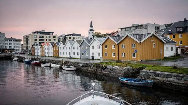
A Narrow Cut at the Edge of Dalane
Most visitors to Rogaland never make it this far south. The itineraries built around Stavanger tend to point northeast, toward the Lysefjord, Preikestolen and Kjeragbolten, and that pull is understandable — those are the sights with the name recognition. Jøssingfjord sits in the opposite direction, near the southern tip of the Dalane region, and it asks for a different kind of attention.
There is no ticket booth, no marked trailhead with a car park counting visitors by the hundred thousand, no single photograph that has made the place famous the way Pulpit Rock’s cliff edge has. What there is instead is a short, steep-sided fjord cutting into a stretch of coastline that looks and feels different from the fjord country most people picture when they think of Norway.
This page treats Jøssingfjord as what it is on the ground: a geological and coastal site, not a theme-park stop. If you are looking for a single dramatic attraction with facilities, opening hours and a gift shop, this is not that. If you are already driving the Dalane coast and want to understand what you are looking at when the road drops toward the water here, this is the page for you.
Where Jøssingfjord Fits on the Dalane Coast
Dalane is the name given to the southernmost stretch of Rogaland, the county that has Stavanger as its administrative centre. It is a quieter, less-visited counterpart to the Ryfylke fjords north and east of the city — fewer chartered buses, fewer souvenir shops, more of the kind of driving where you go an hour without meeting another car. Jøssingfjord lies near the far southern edge of this district, close to where Rogaland gives way to the neighbouring county to the south.
The nearest towns of any size are Egersund to the north and Flekkefjord to the south, and both function mainly as gateways rather than as extensions of the fjord itself — this page is deliberately narrow in scope and does not try to cover either town in depth; if you want to understand what those two places offer in their own right, they have their own coverage on this site. What matters for Jøssingfjord specifically is that it sits on the coastal road connecting the two, a stretch that most travellers driving between Stavanger and southern Norway will pass reasonably close to without necessarily knowing it is there.
That off-the-main-circuit position is really the point. If your trip so far has been the well-trodden Stavanger-Lysefjord axis, Jøssingfjord is a way of seeing a different face of the same county: still coastal, still shaped by rock and water, but quieter and considerably less mediated by infrastructure.
The Rock Beneath: A Different Kind of Norwegian Coastline
Southern Rogaland, including the Dalane district that Jøssingfjord belongs to, sits within an area that geologists and regional tourism bodies alike refer to under the “Magma” name — a reference to the unusual bedrock found across this part of the county, distinct from the granite and gneiss that dominates much of coastal Norway. The exact geological history of that bedrock, its formation and dating, is a subject for specialists and for the interpretive material produced by geopark organisations in the region, and this guide is not the place to restate figures and processes it cannot verify in detail.
What can be said with confidence from simply standing at Jøssingfjord is more modest, and arguably more useful for a visitor: the rock here reads differently underfoot and against the skyline than the coastline around Stavanger itself. Colours, textures and the shape of the cliffs change noticeably as you move south through Dalane.
That is the honest, descriptive version of the geology: not a set of dates and technical terms lifted from a source this page cannot check, but an observation available to anyone who makes the drive and pays attention to what the rock looks like at the water’s edge versus what it looked like an hour earlier near Stavanger. If detailed geological explanation is what you are after, look for material produced directly by geopark or geological-survey sources rather than treating a travel guide as the authority on bedrock chemistry.
What Jøssingfjord Actually Looks Like Today
The fjord itself is short and narrow by Norwegian standards — nothing like the scale of the Lysefjord further north — with steep rock walls rising close to the water on both sides. The inlet is sheltered enough that the water inside is usually calm even when the open coast nearby is not, which is part of what made it a useful natural harbour long before it became anything resembling a destination for travellers. There is a small quay area, a scatter of buildings connected to the fjord’s past industrial and maritime use, and walking paths that let you follow the shoreline and look back at the cliffs from a couple of different angles.
It is not developed for tourism in the way a place like Preikestolen is developed. There is no interpretive centre standing at the water’s edge, no marked network of colour-coded trails, no café with a view. What you get instead is a compact, quiet stretch of coastline that rewards slow looking rather than a single big view. Bring a camera if photography interests you — the contrast between dark rock, calm water and open sky here photographs well precisely because it is uncluttered.
Because the site is small, a visit does not need to take long. Most people spend somewhere between thirty minutes and an hour and a half here, depending on how much walking they want to do along the shore, and that is entirely sufficient — this is not a place that needs a full day carved out of your itinerary on its own.
A Wartime Footnote, Kept in Perspective
Jøssingfjord has a specific footnote in the wider history of the Second World War in Norwegian waters, connected to an incident involving naval vessels here in the early stages of the war, before the German occupation of Norway later in 1940. It is the kind of detail that turns up in general histories of the period and in accounts of the lead-up to the occupation.
This guide is not going to relitigate the details of that episode. Dedicated military-history sources exist for that, written by people working from primary documents rather than from a travel brief, and that is where a reader who wants the specifics — ships, dates, sequence of events — should go. What this page can responsibly say is narrower: the fjord is mentioned in that context in wartime histories, and visitors with an interest in the period sometimes come here partly for that reason.
Beyond that acknowledgment, this guide treats Jøssingfjord primarily as what almost everyone who actually stands here today experiences it as — a dramatic, quiet piece of coastline, worth a stop for its own sake rather than for a single historical claim this page is not equipped to verify in detail.
Getting to Jøssingfjord
There is no public transport route built specifically for visiting Jøssingfjord, and the honest answer for most travellers is that you need a car to reach it comfortably. The fjord sits on the coastal road network linking Egersund and Flekkefjord, off the main E39 that runs the length of this part of Norway, and reaching it means committing to a driving day rather than a quick side trip from central Stavanger.
From Stavanger, plan on roughly an hour and a half to two hours of driving each way, depending on your exact route and how many stops you make along the way — this is not a distance you want to underestimate if you are trying to combine it with anything else in the same day. The road narrows as you get closer to the fjord itself, with the kind of tight curves and modest width typical of Norway’s coastal secondary roads, so keep your speed down and your expectations of overtaking opportunities low.
Parking near the fjord is informal rather than a large managed lot, and there are no facilities to speak of at the site itself — no toilets, no shop, no fuel station right at the fjord. Fill up and use facilities in Egersund or Flekkefjord before or after your visit rather than counting on anything being available at Jøssingfjord.
Walking and Exploring the Fjord
Once you have parked, the way to see Jøssingfjord is on foot, following the informal paths along the shoreline. There is no single official trail with a fixed distance and time, which is part of what makes this a low-pressure stop compared with the heavily managed trails around Preikestolen or Kjerag — you are not signing up for a multi-hour commitment, and you are not competing with a queue.
Footing along the shore can be uneven, with rock and gravel rather than a smooth, graded path, so wear shoes with a reasonable grip rather than anything you would wear on a paved city street. Weather at the coast can turn quickly, and a fjord this exposed to the open sea nearby can pick up wind even on a day that looks calm inland — a windproof layer is worth keeping in the car even in summer.
If you are interested in the fjord’s more industrial or historical structures near the water, look but do not assume anything is safe to enter — older buildings and installations at sites like this are not maintained the way an active tourist attraction would be, and treating them as a photo backdrop from a respectful distance is the sensible approach.
When to Go
Jøssingfjord is reachable by road throughout the year, and it does not depend on a seasonal closure the way the Lysebotn road and Kjerag access do further north. That said, the experience of walking the shoreline is considerably more pleasant from roughly May through September, when daylight hours are longer and the ground underfoot is less likely to be wet, icy or simply unpleasant to navigate.
Outside that window, particularly from late autumn through winter, expect shorter daylight, more wind off the sea, and a generally rawer visit — which some travellers specifically want, since a quiet fjord in bad weather has its own kind of appeal, but it is worth knowing what you are choosing rather than being surprised by it.
| When | What to expect |
|---|---|
| May-September | Longest daylight, easiest walking conditions, best for photography |
| October-November | Shorter days, more wind and rain, fewer other visitors |
| December-February | Cold, short daylight window, dramatic but demanding conditions |
| March-April | Variable, transitional weather; check conditions before relying on a long walk |
What Jøssingfjord Is Not
It is worth being direct about the limits of this site, because the gap between expectation and reality is where a lot of disappointment on a road trip comes from. Jøssingfjord is not a managed national-park-style attraction with a visitor centre, staffed trailhead or ticketed access. It is not a substitute for the Lysefjord in scale — the walls here do not approach the height of what you will see further north, and the fjord itself is far shorter. It does not have an active fishing or tourism economy built around it the way a working harbour town does.
What it is: a compact, distinctive stretch of coastline that fits naturally into a longer day exploring Dalane, particularly if you are already planning to pass between Egersund and Flekkefjord and want a reason to get out of the car partway through.
Combining Jøssingfjord With the Rest of Dalane
Because Jøssingfjord itself only needs an hour or two, it works best as one stop within a longer day rather than as a standalone destination you drive all the way from Stavanger for and back the same afternoon. Pairing it with the wider Dalane southern coast route gives the detour a purpose beyond the fjord alone, and it is the approach this guide would recommend to most readers.
If you want a fuller sense of the lighthouses and coastal towns that bracket this stretch of Rogaland, the dedicated guide to the Dalane coast’s lighthouses covers Egersund and Flekkefjord in the depth this page deliberately avoids. For the practical question of whether you even need your own vehicle for a trip like this, the guide on driving versus not driving around Stavanger is a useful companion — the short version, relevant to Jøssingfjord specifically, is that a car is close to essential here.
If you are packing for a day that mixes coastal walking with the possibility of wind and rain, the general packing guide for hiking in Rogaland applies just as well to an easy coastal walk as it does to a longer mountain trail, since the weather logic is the same. And if you are trying to work out when in the year to schedule a Dalane detour relative to the rest of your Rogaland trip, the month-by-month guide to visiting Stavanger gives useful context, even though Jøssingfjord itself is south of the city.
Budget is worth a word here too. Because there is no entrance fee at Jøssingfjord and no paid attraction to build a day around, this is one of the cheaper stops you will make in Rogaland — the guide to free things to do around Stavanger covers the same logic for the city itself, and the same principle applies down here: your main cost is fuel and whatever you eat along the way, not tickets. It is also worth keeping Norway’s currency situation in mind if you are coming from elsewhere in Europe and assuming euro pricing — it does not apply here.
If your interest in this stretch of coast is more about landscape access and the practicalities of walking on private or semi-managed land, the piece on Norway’s right to roam and where it does and doesn’t apply is directly relevant to how you should approach walking around a site like Jøssingfjord, where there is no fence and no ranger telling you where the path officially ends.
For travellers planning the return leg, Stavanger itself remains the natural base for most of this trip, and browsing the wider day-trip options from the city or the general travel tips section is a reasonable way to decide what else fits around a Dalane detour like this one. A short stop for fuel, food or a museum visit in Egersund on the way south, or a look at Sirdal if you are continuing inland afterward, both fit naturally into the same day without adding much driving.
If ceramics and industrial history interest you more than fjord walking, an easy add-on nearby is a skip-the-line entrance ticket to Egersund’s historic pottery museum, which sits close enough to fold into the same day trip.
And if this detour is part of a longer Rogaland stay that still has Lysefjord on the list, both a boat trip that takes in the Lysefjord and Pulpit Rock from the water and, for more ambitious hikers, a guided hike out to the Kjeragbolten boulder are worth booking ahead, since both depend on weather and fill up in the summer season.
Common Questions About Visiting Jøssingfjord
Do I need a car to visit Jøssingfjord?
Yes, in practice. There is no public transport route built for reaching the fjord directly, and it sits on a secondary coastal road between Egersund and Flekkefjord that is realistically only convenient by car.
How long should I plan for a visit?
Most visitors spend thirty minutes to an hour and a half at the fjord itself. It works best as one stop within a longer day exploring the Dalane coast rather than a destination you drive to and from on its own.
Is there an entrance fee?
No. There is no ticketed attraction or visitor centre at Jøssingfjord, and no entrance fee for walking the shoreline.
What is the Magma Geopark, and does it explain the whole fjord?
“Magma” is the name used for the wider geopark landscape covering parts of southern Rogaland, referring to bedrock that differs from the granite and gneiss found around much of the Norwegian coast. This guide describes what the rock looks like on the ground rather than restating detailed geological dating or process claims it cannot verify.
Is Jøssingfjord connected to a wartime event?
It is mentioned in general histories of the early Second World War period in connection with a naval incident here before Norway’s 1940 occupation. This guide does not go into the details of that episode and treats the fjord primarily as a coastal and geological site; readers wanting the historical specifics should consult dedicated military-history sources.
Can I combine Jøssingfjord with Egersund or Flekkefjord in one day?
Yes, and that is the recommended approach. Jøssingfjord sits between the two towns on the coastal road, and pairing it with a stop in one or both, or with the broader Dalane coast route, makes for a more efficient day than treating the fjord as a standalone trip.
Is the walking here difficult?
No formal trail exists, and the shoreline paths involve uneven rock and gravel rather than a graded surface, but there is no significant elevation gain or technical difficulty comparable to hikes like Preikestolen or Kjeragbolten. Reasonable footwear is enough for most visitors.
What’s the best time of year to visit?
Roughly May through September, for longer daylight and easier underfoot conditions. The site is reachable by road year-round, but autumn and winter bring shorter days, more wind and wetter ground.