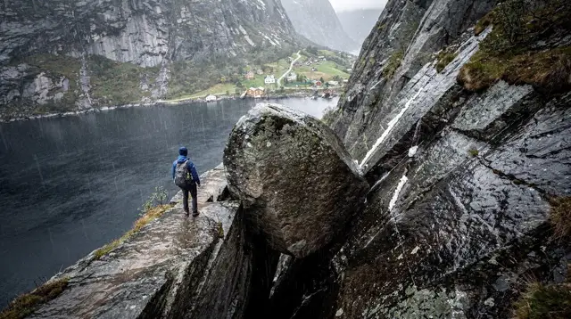
Dalsnuten: The Hike Sandnes Does After Work
How long is the Dalsnuten hike and is it hard?
Dalsnuten is roughly 5 km round trip from the main Sandnes trailhead, with about 260 m of elevation gain, and most people finish in 1.5 to 2.5 hours. It is steep in places but far shorter and less exposed than Preikestolen or Kjeragbolten, which makes it a popular after-work climb for locals rather than a tourist pilgrimage.
The Hike Locals Actually Do on a Tuesday
Every region with a famous, crowd-pulling hike also has a quieter one that belongs to the people who live there, and around Stavanger and Sandnes that hike is Dalsnuten. It is not on the same scale as Preikestolen, it does not require a fjord crossing, and nobody plans a whole day around it. What it offers instead is something more useful for most visitors: a real hike, with a real summit and a real view, that fits into an afternoon or a spare evening without derailing the rest of a trip.
Dalsnuten sits on the edge of Sandnes, a short drive or bus ride from central Stavanger, rising to 323 metres above the surrounding lowland. On any mild evening you will find it full of local families, runners doing hill repeats, retirees with poles, and dogs that clearly know the route better than their owners. That local rhythm is the whole point of this guide: Dalsnuten is worth doing precisely because it is ordinary, accessible, and genuinely enjoyable, not because it is dramatic.
Where Dalsnuten Actually Is
Dalsnuten rises just south of Sandnes, inland from the coast and well away from the Lysefjord system. That geography matters, because it is easy for visitors skimming several hike names at once to lump Dalsnuten in with Preikestolen, Kjeragbolten or the trails around Flørli. It shares nothing with them beyond the word “hike.” There is no fjord below you here, no chained rock face, and no 400-metre drop to the water. Dalsnuten’s landscape is rolling heathland, exposed granite knolls, small lakes, and farmland, closer in character to the hills around Dalsnuten itself than to anything on the fjord.
The main trailhead, Sandvedparken, is on the southern fringe of Sandnes and has free parking, a large gravel lot, and clear trail markers from the moment you step out of the car. A second, slightly longer approach starts near Kongeparken and is popular with people who want to extend the walk. Either way, you are hiking through a peri-urban landscape that feels rural within minutes of leaving a car park that itself sits within the built-up edge of Sandnes.
The Trail: What to Expect
From the Sandvedparken trailhead, the path climbs gradually at first through low forest and open heath, following a well-trodden gravel and dirt track marked with red T signs, the standard Norwegian hiking waymark. After the first kilometre or so, the trail steepens noticeably, crossing bare granite slabs and short rocky steps where hands occasionally help on the way up. None of it is technical climbing, but it is genuinely steep in places, and wet rock can be slippery, so grip matters more than distance here.
The final approach to the summit opens onto exposed rock with wide views in every direction well before you reach the actual high point, which is part of why the hike feels rewarding disproportionate to its length. At the top, a broad rock platform gives space for dozens of people to sit, eat, and watch the view without crowding, which is a useful contrast to the single-file bottleneck that can build up on busier regional trails.
Coming down, most hikers retrace their steps, though a loop combining the Sandvedparken and Kongeparken approaches is a common variation for people who want a longer outing or a way to see two sides of the hill in one trip. Trail signage at the summit and at key junctions makes this loop straightforward to follow without a dedicated map.
How Long It Takes and How Hard It Really Is
| Detail | Dalsnuten |
|---|---|
| Round-trip distance | About 5 km (main route) |
| Elevation gain | About 260 m |
| Typical time | 1.5 to 2.5 hours |
| Summit height | 323 m |
| Terrain | Gravel path, then bare rock and short steep sections |
| Safety railing | None; open rock summit |
| Entry cost | Free |
| Parking | Free at Sandvedparken |
Compared with a full day committed to Preikestolen, or the six-to-eight-hour chain-assisted route to Kjeragbolten, Dalsnuten is a fraction of the effort and a fraction of the time. That is exactly why it works so well as a late-afternoon or early-evening activity: you can finish a work day, drive or bus to Sandvedparken, be at the summit within an hour, and be back at your accommodation in time for dinner. It is not a lesser version of the big hikes; it is a different category of hike, built for repetition and convenience rather than a once-in-a-trip effort.
Fitness needed is modest. Anyone who walks regularly and has reasonably sturdy footwear will manage the climb without difficulty, though the steep rock sections mean flip-flops or worn smooth-soled shoes are a genuinely bad idea. Families with children who can already manage a moderate uphill walk generally do fine, and it is common to see the trail dotted with kids scrambling the rockier stretches under only loose supervision, a good indicator of how contained the exposure is relative to something like Kjeragbolten.
Do Not Confuse This With the Lysefjord Hikes
It is worth being direct about a mix-up that trips up a surprising number of visitors planning a Rogaland itinerary: Dalsnuten has nothing to do with the Lysefjord trail network. It is not a shorter version of the Preikestolen approach, it does not connect to the Kjerag plateau, and it shares no trailhead, ferry, or road with either. If your goal is fjord scenery, chained rock sections, or the specific views that make Preikestolen and Kjeragbolten famous worldwide, Dalsnuten will not deliver that, and treating it as a warm-up for those hikes sets the wrong expectation entirely.
What Dalsnuten does share with those better-known trails is only the format: a marked path, a summit, a view. The scale, the crowd, the terrain, and the psychological character of the hike are all different. Preikestolen draws roughly 300,000 visitors a year to a single fjord-edge plateau; Dalsnuten draws a rotating cast of Sandnes residents on their way home from work, and it shows in the atmosphere at the top. If you are trying to decide which regional hikes fit your itinerary and how they differ from each other in depth, that broader comparison belongs elsewhere; this page exists specifically to keep Dalsnuten in its own, more modest lane.
Getting There From Stavanger and Sandnes
Dalsnuten’s biggest practical advantage over the region’s marquee hikes is proximity. From central Stavanger, the Sandvedparken trailhead is a drive of well under half an hour, and from central Sandnes it is closer still, often reachable in ten minutes by car. Free parking at the trailhead removes one of the small frictions that affects Preikestolen, where trailhead parking is paid.
For travellers without a car, Kolumbus local buses connect Stavanger and Sandnes to points near the trailhead, followed by a short walk to the start of the path; anyone weighing up whether to rent a car at all for a Rogaland trip should treat Dalsnuten as one of the strongest arguments for going car-free for at least part of a visit, alongside other close-in options within Sandnes and central Stavanger itself.
Because the trailhead sits so close to Sandnes’ own attractions, it is easy to combine Dalsnuten with a broader look at the town rather than treating it as an isolated outing.
a guided Dalsnuten hike with a local leader is worth considering if you would rather have route-finding, pacing, and local commentary handled for you, particularly on a first evening in the area when daylight is limited.
Best Time of Day, and Year, to Go
Locals overwhelmingly favour early evening, and for good reason: the light softens, the day’s heat (such as it is, in a Stavanger summer) fades, and the summit rock cools enough to sit on comfortably. Sunset from Dalsnuten over the lakes and farmland toward Sandnes is a genuinely popular local habit rather than a tourist recommendation dressed up as one, and arriving an hour or so before sunset gives time to reach the top, settle in, and watch the light change without needing a headlamp for the way down.
The hike is walkable across most of the year, unlike the Lysebotn road that gates access to Kjerag in winter. Summer evenings offer the longest daylight windows and the most sociable atmosphere at the summit; spring and autumn bring quieter trails and cooler air that suits the steep sections well. Winter hiking is possible but demands more care: the exposed rock near the top can ice over, and the steep sections that are a minor scramble in summer become genuinely hazardous when frozen, so proper footwear or traction aids matter far more here in January than they do in July.
What to Bring
Dalsnuten does not demand technical hiking gear, but a short list of sensible choices makes a real difference given the steep, sometimes wet rock underfoot.
| Item | Why it matters |
|---|---|
| Sturdy shoes with grip | Bare granite sections are slick when wet |
| Layered clothing | Coastal Rogaland weather shifts quickly |
| Light rain shell | Showers are common even on otherwise fine days |
| Water bottle | No facilities on the trail itself |
| Headlamp (evening hikes) | Useful if you linger past sunset |
| Trekking poles (optional) | Helpful on the steepest descent sections |
For a fuller regional packing list that covers the bigger hikes as well, the dedicated guide on what to pack for hiking in Rogaland goes into more depth than is needed for Dalsnuten alone, but the core logic, dress for wind and rain regardless of the forecast, applies here just as much as on Kjerag.
Making an Evening of It
Because Dalsnuten sits so close to Sandnes, it slots naturally into a slower, more local kind of evening than most one-off tourist stops allow. A common local pattern is to hike up before sunset, watch the light fall over the lakes below, then head back into Sandnes for dinner, treating the hike as a short outdoor interlude rather than the day’s main event. That rhythm is worth borrowing even on a short visit: rather than scheduling Dalsnuten as a standalone excursion, pairing it with an evening in Sandnes turns it into the kind of low-key, resident-style outing that a lot of travellers say they wish they had more of.
If you want to add a second easy activity nearby without a long drive, the climbing structures and zip lines at Skogsprett Adventure Park sit within reasonable range and suit families looking to combine a short hike with something more active for kids afterward. Our dedicated Skogsprett Adventure Park guide covers ticket types and age ranges in detail.
an entry ticket to Skogsprett’s net and climbing park is a straightforward way to book that add-on in advance if you are travelling with children who might not be satisfied with a summit view alone.
Booking a Guided Option
Most people hike Dalsnuten independently; the trail is short, well marked, and forgiving enough that a guide is a preference rather than a necessity. That said, a guided option has genuine appeal for visitors short on time, travelling solo and wanting company, or hoping to combine Dalsnuten with a wider look at the region in a single booked activity rather than piecing one together themselves.
a guided day tour from Stavanger covering both Månafossen waterfall and Dalsnuten pairs this local hike with one of Ryfylke’s better-known natural sights, which suits travellers who want more scenery packed into a single organised day without arranging transport themselves.
For visitors whose real priority is Sandnes and Stavanger’s town-level sights rather than the outdoors specifically, it is worth knowing Dalsnuten can also be treated as a short add-on to a broader city visit rather than a dedicated excursion in its own right. Local operators running general area tours from Sandnes sometimes work Dalsnuten’s viewpoint into a wider itinerary, which is a reasonable option if hiking is not your main interest but you still want the view.
Where Dalsnuten Fits in a Longer Trip
For a first visit to the region, Dalsnuten is not usually the headline reason to come, and it should not compete for the same half-day slot as Preikestolen or a Lysefjord cruise. Its real value shows up on longer stays, second visits, or trips built around Sandnes specifically, when a shorter hike that does not eat a whole day becomes genuinely useful for filling an evening productively. Anyone building out a broader Rogaland itinerary that already includes the region’s bigger names will find Dalsnuten works best slotted into a rest day or an evening after a longer excursion elsewhere, rather than stacked alongside another full hike on the same day.
If you are choosing between several shorter, easier trails around Stavanger and Sandnes for exactly this kind of low-commitment outing, our roundup of easy hikes near Stavanger sets Dalsnuten alongside its closest local alternatives. For travellers piecing together a car-free itinerary, the do you need a car in Stavanger guide addresses how far bus and local transport realistically get you, Dalsnuten included. And if budget is a consideration, Dalsnuten belongs firmly on the list in our guide to free things to do around Stavanger, since the entire hike costs nothing beyond getting to the trailhead.
Families weighing up which activities suit children across a longer stay can find Dalsnuten discussed alongside gentler, kid-friendly options in our Stavanger with kids guide, and travellers planning a single, tightly packed day in the city itself can see where a short hike like this could realistically fit in our one day in Stavanger itinerary.
For hikers specifically looking to string together several solo outings of varying length across a visit, Dalsnuten is one of the anchor stops in our solo hikes around Stavanger itinerary, and it is listed under the hiking trails category alongside the region’s other marked routes.
a private driving tour covering Stavanger’s city highlights is a reasonable way to see the town itself efficiently on the same day as a Dalsnuten hike, if your schedule only allows one combined outing rather than two separate excursions.
Common Questions About Hiking Dalsnuten
How long does the Dalsnuten hike take?
Most hikers cover the round trip in 1.5 to 2.5 hours, depending on fitness and how long they linger at the summit. It is a short outing compared to Preikestolen or Kjeragbolten, which is exactly why locals treat it as a routine after-work climb rather than a full-day trip.
Is Dalsnuten suitable for beginners or families?
Yes, with a caveat: the trail is short but genuinely steep in sections, with bare rock and tree roots underfoot. Reasonably fit children usually manage it fine with sturdy shoes, but it is not a flat, stroller-friendly path.
Is Dalsnuten the same area as Preikestolen or Lysefjord?
No. Dalsnuten sits inland near Sandnes, away from the Lysefjord entirely, with a different landscape, different crowd, and none of the fjord-side cliff exposure that defines Preikestolen or Kjeragbolten.
Do I need a car to reach Dalsnuten?
A car makes it easiest, since the main trailhead has free parking, but Dalsnuten is also reachable by local bus from central Sandnes or Stavanger followed by a short walk, which suits travellers without a car.
Is there an entrance fee for Dalsnuten?
No. Dalsnuten is open, unticketed public land under Norway’s right to roam, so there is no charge to hike the trail or stand at the summit.
What is the view like from the top of Dalsnuten?
The 323 m summit gives an open panorama over Sandnes, Stavanger, the surrounding lakes and farmland, and on clear days the hills toward Jæren, which is why locals return to watch the sunset there so often.
When is the best time to hike Dalsnuten?
Dalsnuten is walkable most of the year, but early evening on a clear day is the local favourite for the light and for avoiding daytime heat, while icy conditions in winter call for proper footwear or crampons.
tours.hiking-trails
Verified deep-linked GetYourGuide tours. Book through these links and we earn a small commission at no cost to you.
GetYourGuide does not provide a product photo for this activity — the image shows the meeting point, photographed by us.