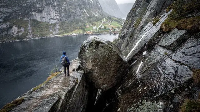
What to Pack for Hiking in Rogaland
What should you pack for hiking in Rogaland?
Waterproof boots with ankle support, a hard-shell rain jacket and rain trousers, synthetic or wool base layers (never cotton), and a warm mid-layer for the top of any climb. Rogaland gets 1,180-1,250 mm of rain a year, so plan for wet trails rather than hoping for a dry window.
Pack for the climate, not the forecast
Rogaland receives somewhere between 1,180 and 1,250 mm of rain a year, and that number is the single most useful fact for building a packing list here. It is not a warning about occasional bad luck — it is a description of the default weather. A clear morning in Stavanger tells you almost nothing about conditions a few hundred metres up on an exposed plateau, where wind and cloud can move in within the hour. The trails around Lysefjord, Preikestolen and Kjeragbolten all sit in this same weather system, and the gear that works well in a dry mountain range elsewhere often falls short here.
This guide is deliberately not about any single trail. It covers the equipment and layering choices that hold up across the region — from an easy afternoon on Dalsnuten to a full day toward Månafossen in Ryfylke. If you are looking for distances, timing or trail-specific advice, the individual hike guides linked throughout cover that; this one is about what goes in the bag.
Footwear: the piece worth getting right
Waterproof hiking boots with ankle support are the baseline for hiking almost anywhere in this region. Trails that look like firm gravel paths on a dry day become slick, muddy or running with surface water after rain, and rain is the norm rather than the exception. Smooth-soled trainers or lightweight trail runners can work on a handful of short, flat routes, but they are a poor match for the rocky, uneven and often wet terrain typical of Rogaland’s better-known hikes.
A few points matter more here than in a drier climate:
- Waterproofing, not just water resistance. A genuinely waterproof membrane earns its keep on trails where puddles and running water are common underfoot.
- Tread depth. Wet granite and wet gravel both get slippery; aggressive tread reduces slips on descents, which is where most minor injuries happen.
- Ankle support. Loose rock and root sections are common on routes through Ryfylke and around Flørli, and a rolled ankle is a bad way to end a day far from the trailhead.
- Break them in beforehand. New boots on a long day, especially one with wet socks, is a reliable way to end up with blisters.
Bring a spare pair of hiking socks in a dry bag. Wet feet are one of the most common complaints on longer Rogaland hikes, and a fresh pair partway through a long day, or waiting in the car for the drive home, makes a real difference.
Layering: build it around getting wet
The layering system that works best here assumes, at some point, that rain or sweat will get through at least one layer. The goal is not to stay perfectly dry — that is rarely realistic over a multi-hour hike in this climate — but to stay warm even when damp.
| Layer | Purpose | What to avoid |
|---|---|---|
| Base layer | Moves sweat away from skin | Cotton — it absorbs moisture and stays wet |
| Mid layer | Traps warmth, especially at rest stops | A single thick layer with no ventilation options |
| Outer shell | Blocks wind and rain | A “water-resistant” jacket instead of a true waterproof one |
| Legs | Keeps rain and wind off | Jeans or cotton trousers |
Base layer: synthetic fabric or merino wool, never cotton. Cotton holds onto moisture, whether from rain or your own sweat, and a wet cotton layer against skin cools you down fast once wind picks up — which happens often on exposed sections like the plateau at Preikestolen or the ridge approach to Kjeragbolten.
Mid layer: a fleece or lightweight insulated jacket that you can add at a summit or remove on a climb. Temperatures at altitude on these hikes run noticeably cooler and windier than in Stavanger itself, even though the vertical gain on routes like Preikestolen’s roughly 350 m is modest by mountain standards elsewhere.
Outer shell: a genuine waterproof, breathable hard-shell jacket, not a splash-resistant softshell. Given the region’s rainfall totals, this is the one item worth spending real money on. Waterproof rain trousers matter just as much as the jacket — wet legs from knee-high brush or driving rain are just as miserable as a wet torso, and jeans in particular become heavy, cold and slow to dry.
What else to carry
Beyond boots and layers, a short list of items consistently earns its place in a Rogaland hiking pack:
- A pack cover or a dry bag liner for your backpack’s contents. Even a “water-resistant” pack will let water in during sustained rain.
- Gloves and a warm hat, even in summer. Wind chill on an exposed section can be sharp, and a hat that also blocks light rain is doubly useful.
- A headlamp, if there is any chance of finishing later than planned — daylight fades faster than expected under heavy cloud cover.
- Trekking poles, optional but genuinely helpful on the steep, often-wet sections found on trails throughout the region, including the chained stretches near Kjeragbolten.
- More water and food than you think you need. Cool, damp weather burns more energy than people expect, and there are few facilities once you are past a trailhead.
- A basic first-aid kit and a fully charged phone, particularly for longer or more remote routes in Ryfylke.
- A dry change of clothes left in the car or at your accommodation. Even a well-executed rain-gear setup usually ends the day with at least some dampness, and dry clothes waiting at the end make a real difference to how the rest of the day feels.
A simple packing checklist
| Category | Item | Why it matters here |
|---|---|---|
| Feet | Waterproof hiking boots | Trails are wet more often than dry |
| Feet | Spare wool or synthetic socks | Wet feet are the most common complaint |
| Torso | Synthetic or wool base layer | Cotton stays wet and cold |
| Torso | Fleece or light insulated mid layer | Altitude and wind cool you fast |
| Torso | Waterproof hard-shell jacket | Rain is the regional default, not an exception |
| Legs | Waterproof rain trousers | Wet legs chill quickly, especially in wind |
| Extremities | Hat and gloves | Wind chill is sharper than sea-level temperatures suggest |
| Pack | Rain cover or dry-bag liner | Standard backpacks are not fully waterproof |
| Safety | Headlamp, first-aid kit, charged phone | Facilities and daylight are both limited on longer routes |
| Comfort | Trekking poles | Useful on steep, wet, uneven ground |
| After the hike | Dry change of clothes | Even good gear usually ends the day slightly damp |
Matching gear to the kind of day you are planning
Not every hike here demands the same setup. A short, well-marked walk close to Stavanger asks less of your gear than a long day out toward Kjerag. If you want the full rain-gear list without a specific trail in mind, this section is where the two connect.
For an easier, half-day outing, something like Dalsnuten is a reasonable place to test a new rain jacket or new boots before committing to a longer route — and a guided hike with a local on Dalsnuten is a low-stakes way to see how your gear performs alongside someone who already knows the terrain. If you would rather have that local knowledge built in from the start, a guided hike up Dalsnuten with a local guide takes the guesswork out of both the route and the pacing.
Longer, more remote days in Ryfylke or toward Haugesund call for the fuller kit described above — full rain layers, spare socks, and enough food and water for a day with fewer services along the way. A guided hiking trip on Himakånå near Haugesund is a good example of a longer outing where having a guide manage pacing and route-finding lets you focus on staying warm and dry rather than second-guessing the weather.
For multi-hour routes with real elevation and exposed sections, treat the checklist above as a minimum rather than a maximum, and check current conditions before you go — see what tends to close in winter around Preikestolen and Kjerag and how rain actually affects the trail underfoot for specifics.
Seasonal notes
Rogaland’s climate is mild for its latitude of 58.97°N, but “mild” does not mean dry or calm. January averages roughly 1-2°C, and even July — the warmest month — averages only around 16-17°C. That narrow temperature range across the year means the same core layering system works in most seasons; what changes is how much insulation you add underneath the waterproof shell.
Winter hiking adds real complications beyond clothing: some access roads, including the route to Lysebotn used for reaching Kjeragbolten, close for the season, and trail conditions on higher routes can include snow and ice that call for different footwear entirely. If you are planning a winter trip, read up on what actually stays open and closed before you finalise a packing list, since crampons or microspikes may belong on it in place of standard boots.
Rain gear matters just as much in summer. A dry, sunny start to the day in Stavanger is not a reliable predictor of conditions a few hours later on an exposed trail, and packing light rain gear “just in case” undersells how often it is actually needed here — closer to standard equipment than a backup plan.
Where this fits with route planning
Gear choices connect directly to which hikes make sense on a given day. If low cloud and heavy rain are forecast, an exposed, multi-hour route is a worse idea than one of the easier hikes closer to Stavanger, regardless of how good your rain jacket is. If you are building out a full trip and want to see how hiking days fit around fjord cruises, city time and driving days, the rain-proof Stavanger itinerary and the broader solo hikes itinerary are useful starting points, and the hiking trails category page lists the region’s routes side by side.
Good gear does not change the weather, but it does change how much the weather matters. A properly waterproofed setup turns a rainy day on the trail into a normal one rather than a miserable one — and in a region with over a metre of rain a year, that is the difference that actually decides whether a hike goes well.
tours.hiking-trails
Verified deep-linked GetYourGuide tours. Book through these links and we earn a small commission at no cost to you.
GetYourGuide does not provide a product photo for this activity — the image shows the meeting point, photographed by us.