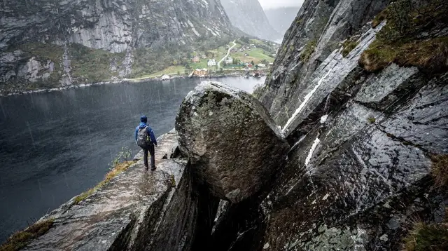
The Best Easy Hikes Near Stavanger (No 4-8 Hour Commitment Required)
What are good easier hikes near Stavanger besides Preikestolen and Kjeragbolten?
Dalsnuten, a short hill walk close to Sandnes, and Himakåna near Haugesund are the most reliable low-commitment options, both under three hours round trip. Månafossen waterfall in Ryfylke and several walking routes along the Jæren beaches offer flatter, shorter alternatives with a real payoff at the end.
Not everyone wants Preikestolen’s four hours or Kjerag’s chains
Most articles about hiking near Stavanger open with Preikestolen and close with Kjeragbolten, and for good reason: they are the region’s two signature routes, each covered in detail in our guide to how long Preikestolen actually takes and our comparison of Kjeragbolten and Preikestolen. But a full day committed to an 8 km round trip with 350 m of elevation gain, or a 6-8 hour route secured by chains above a 1,000 m drop, is not what every visitor wants, and it is not what every visitor’s schedule, fitness, or travel party allows.
This guide is for the other kind of hiking day: a morning or afternoon slot, a family group with mixed ability, a rain-shortened window, or simply a preference for a shorter walk with a clear payoff rather than a half-day expedition. None of the hikes below are a replacement for Preikestolen’s fjord-wall panorama or Kjeragbolten’s exposed boulder — they are a different, quieter experience, and treating them as an equivalent substitute sets the wrong expectation. What follows are the routes around Stavanger and wider Rogaland that reward a shorter commitment.
Dalsnuten: the closest short hill to Sandnes
Dalsnuten is the default answer locals give when asked for a hike that will not eat the whole day. It sits just outside Sandnes, part of the same conurbation as Stavanger, and the round trip runs about 4-5 km with roughly 250 m of elevation gain — steep in short bursts, but on a well-worn path with no chains or scrambling required.
Most people finish in 1.5 to 2 hours including a stop at the summit, where the reward is a wide panorama over Sandnes, Stavanger, and the surrounding lakes and hills. It is popular enough with residents that you will share the trail, especially on weekend mornings, but nothing like the queues that build up on the Preikestolen trail in July and August.
Full route notes, trailhead directions, and seasonal advice are in our dedicated Dalsnuten hike guide. If you would rather not navigate the approach roads and trail junctions solo, a local guide can also walk the route with you and add context on the geology and history of the area.
a guided half-day hike up Dalsnuten with a local guide covers transport logistics and pacing, which suits visitors without a rental car based in Sandnes or central Stavanger.
Himakåna: a coastal alternative near Haugesund
North of Stavanger, near Haugesund, Himakåna offers a moderate trail with views over the coastal islands of Karmøy and the surrounding fjord landscape. It is a step up in effort from Dalsnuten — expect a genuine climb — but still typically wraps up in 2-3 hours round trip, well short of a full-day commitment.
The trail is less crowded than anything near central Stavanger simply because Haugesund sits further out, making it a good fit for travelers already exploring Haugesund and Karmøy rather than a dedicated day trip from Stavanger itself. Our Himakåna hike guide covers the trailhead access, which is easiest reached by car.
a guided hiking trip up Himakåna near Haugesund is worth considering if you are combining this hike with other stops around Karmøy and Avaldsnes and want the logistics handled.
Månafossen: a waterfall hike with a real trail, not a roadside stop
In the Ryfylke area, near Frafjord, Månafossen is Rogaland’s tallest waterfall at around 92 m, but reaching a good view of it involves an actual hike, not a car park viewpoint. The trail climbs through forest from the car park to a viewing point near the top of the falls, with a round trip of roughly 5 km and 1.5 to 2 hours depending on your pace and how long you spend at the top.
It is a good option for travelers already spending a day in Ryfylke, pairing naturally with a stop at Frafjord itself or a wider loop through Gloppedalsura and Byrkjedal. Full trail notes are in the Månafossen waterfall hike guide, including notes on the best season to see the falls at full flow.
If a hike to a waterfall is not quite what you are after and you would rather experience Ryfylke’s fjords from the water instead, a guided kayak or paddleboard tour around Frafjord covers similar scenery from a different angle, with no hiking involved at all.
Jæren: flat coastal walking, not a mountain hike
South of Stavanger, the Jæren coastline breaks the pattern of fjords and cliffs that defines most of Norway’s scenery, offering long, flat sandy beaches instead. Walking here is a different category of activity entirely — no elevation gain, no trail markers to follow, just open beach and dune paths that can be as short or long as you like.
Orre beach and the stretch toward Kvassheim lighthouse are the most rewarding sections for a walk of an hour or two, with wind-shaped dunes and, depending on season, seabird colonies along the way. It suits families, anyone recovering from a bigger hike the day before, or a rain-affected afternoon when a low-lying, easy-to-abandon walk beats a forest trail. Our Jæren beaches day trip guide covers a route linking several beach sections by car, and the Kvassheim and Obrestad lighthouses walk is a good self-contained option if you only have an hour or two to spare.
Comparing the easier options
The table below lines up the routes covered here against each other, and against Preikestolen and Kjeragbolten for scale — not as an invitation to swap one for the other, but to help you choose the right hike for the time and energy you actually have.
| Hike | Round trip | Typical time | Elevation gain | Difficulty |
|---|---|---|---|---|
| Jæren beach walk (Orre to Kvassheim) | 3-8 km, flexible | 1-2 hours | Minimal | Easy |
| Dalsnuten | 4-5 km | 1.5-2 hours | ~250 m | Easy to moderate |
| Månafossen | ~5 km | 1.5-2 hours | Moderate | Moderate |
| Himakåna | Varies, moderate distance | 2-3 hours | Moderate to steep | Moderate |
| Preikestolen (for comparison) | ~8 km | 4-5 hours | ~350 m | Moderate, high traffic |
| Kjeragbolten (for comparison) | 10-12 km | 6-8 hours | Significant, chained sections | Strenuous |
Notice that even Dalsnuten’s elevation gain is not far off Preikestolen’s — the difference is distance and total time commitment, not necessarily steepness. None of the shorter hikes above involve chains, exposed drops, or the kind of terrain that demands hiking poles and hours of daylight buffer the way Kjeragbolten does.
Getting to the trailheads
Access is the main practical difference between these hikes and the region’s two signature routes, which run organised shuttle buses in season. Dalsnuten is the most accessible without a car, reachable from Sandnes by Kolumbus bus and a short walk to the trailhead. Himakåna and Månafossen are more comfortably reached with a rental car, since public transport options thin out once you leave the main Stavanger-Sandnes corridor, and the Jæren beaches are best explored with a car that lets you hop between beach access points along the coast road.
If you are not driving and want to see more of Ryfylke or the coastline north of Stavanger without renting a car, a private guided day covers the driving and lets you focus on the walking. a private driving tour covering Stavanger’s highlights can also be adapted to include a stop at one of the easier trailheads if you ask in advance.
For those pairing a short hike with hiking gear questions, our what to pack for hiking in Rogaland guide covers footwear and layering advice that applies just as much to a two-hour Dalsnuten walk as it does to a full Kjerag day, since Rogaland’s weather does not scale its unpredictability down for shorter trails.
When to go
Rogaland’s climate favours roughly May through September for comfortable hiking, though these shorter, lower-elevation trails are more forgiving outside that window than Preikestolen or Kjerag, which can become genuinely difficult or dangerous in snow and ice. Dalsnuten and the Jæren beach walks in particular remain walkable through much of the year, weather permitting, since neither depends on a mountain road staying open. Månafossen and Himakåna are best treated as spring-to-autumn routes, since forest trails at higher elevation hold snow and mud longer into the season.
If your trip includes a stretch of poor weather, our rain-proof Stavanger itinerary groups activities, including some of these shorter walks, by how well they hold up when the forecast turns. And if you are trying to decide how many hiking days to build into a wider trip, our guide on how many days you need in Stavanger factors in a mix of city time, one big hike, and a shorter one like these.
Solo hikers and mixed-ability groups
These shorter routes work particularly well for two situations that Preikestolen and Kjeragbolten handle less gracefully: solo travelers who want a hike without the day-long commitment, and groups where fitness or confidence levels differ. Our solo hikes near Stavanger itinerary leans on several of the routes above for exactly that reason. For families specifically, see our broader Stavanger with kids guide, which separates out which trails suit which ages.
FAQ: choosing an easier hike around Stavanger
Is Dalsnuten a good alternative to Preikestolen?
Not as a substitute for the view. Dalsnuten is a short, steep-but-manageable hill near Sandnes with a wide panorama over the Stavanger area, doable in under two hours. It suits people who want a genuine climb without committing a full day, not people chasing the Lysefjord view.
How long does the Dalsnuten hike take?
Most walkers complete the round trip in 1.5 to 2 hours, covering around 4-5 km with roughly 250 m of elevation gain. It is steep in places but does not require chains, ropes, or technical scrambling.
Is Himakåna suitable for beginners?
Himakåna, near Haugesund, is a moderate trail rather than a beginner stroll, but it is far shorter and less exposed than Preikestolen or Kjeragbolten, typically taking 2-3 hours round trip with good views over the coast and islands.
Can you do an easy hike near Stavanger without a car?
Some, but not all. Dalsnuten is reachable from Sandnes by local Kolumbus bus plus a short walk, while Himakåna and Månafossen are easier to reach with a car or an organised transfer, since public transport to those trailheads is limited.
Is Månafossen a hike or just a viewpoint?
It is a proper short hike, not a roadside viewpoint. The trail from the car park near Frafjord climbs through forest before reaching the top of the falls, with a round trip of around 5 km and 1.5 to 2 hours depending on how long you linger.
Are these hikes as scenic as Preikestolen or Kjeragbolten?
They are scenic in a different, quieter way, not a substitute for the fjord-wall drama of Preikestolen or the exposure of Kjeragbolten. Treat them as their own destinations rather than a shortcut to the same view.
What should I pack for a short hike in Rogaland?
Waterproof boots or trail shoes, a rain shell, and layers regardless of season, since Rogaland’s weather changes quickly even on short trails. None of these hikes require technical gear, but sturdy footwear matters on wet rock and muddy sections.
tours.hiking-trails
Verified deep-linked GetYourGuide tours. Book through these links and we earn a small commission at no cost to you.
GetYourGuide does not provide a product photo for this activity — the image shows the meeting point, photographed by us.