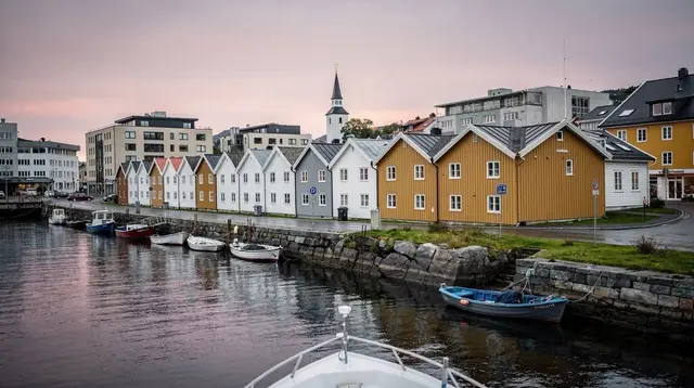
Kvassheim to Obrestad: A Quiet Lighthouse Walk on Jæren
How long is the walk between Kvassheim and Obrestad lighthouses?
The coastal path between Kvassheim and Obrestad lighthouses covers roughly 8 km one way along the Jæren shoreline, about 2 to 2.5 hours of flat, easy walking. Most visitors do it as a one-way point-to-point walk with a car or bus back, rather than an out-and-back hike.
Most people who come to the Jæren coast drive from beach to beach, stop for photos, and move on. The walk between Kvassheim and Obrestad lighthouses is a different way to see the same stretch of coastline: on foot, at a pace slow enough to notice the dunes, the old sea defences, and the two very different lighthouses that mark each end.
Why walk instead of drive the Jæren coast
The main Jæren beaches day trip is built around a car, moving between Orre, Borestranden, Solastranden and the southern end of the coast in a single day. That is the right approach if you want to see the whole sweep of Jæren in one visit. This walk is not a replacement for that day trip — it is one piece of it, taken slowly.
Between Kvassheim lighthouse and Obrestad, the coast is quieter than the busiest sections near Stavanger and Sola. There are no cafés at the trailhead, no crowds gathering for sunset photos, and long stretches where the only sound is wind and surf. If your image of Jæren is one packed car park at Borestranden on a warm Sunday, this walk is the corrective.
The route in detail
The path runs along the shoreline, mostly on packed sand, gravel track and short grass, with occasional low dunes to climb over. It is flat almost the entire way — there is no real elevation gain to speak of, which sets it apart from hikes like Dalsnuten or the trail up to Preikestolen.
| Detail | Kvassheim to Obrestad |
|---|---|
| Distance | Roughly 8 km one way |
| Time | About 2 to 2.5 hours at an easy pace |
| Terrain | Flat: sand, gravel track, short grass, occasional dunes |
| Elevation gain | Minimal |
| Shade | Almost none |
| Route type | Point-to-point, not a loop |
| Best base | Bryne or Stavanger, by car |
Because it is point-to-point rather than a loop, the practical question is always how you get back. Two cars, one left at each end, is the simplest solution if you are travelling with others. Walking there and back the same way turns it into a 16 km day, which is a reasonable option if you want more time on the coast rather than less.
Kvassheim lighthouse and its surroundings
Kvassheim marks the northern end of this walk. The lighthouse here is smaller and less photographed than some of Norway’s better-known towers, which is part of the appeal — you are likely to have it largely to yourself. The area around it includes former coastal defence installations, remnants of the fortifications built along this shore during the Second World War, now weathered into the landscape rather than fenced off as a formal museum site.
From Kvassheim, the path heads south along the top of the beach, with the North Sea on one side and low farmland on the other. This is one of the few places in Norway where you can walk for hours along open sand and dune with almost no fjord or mountain in sight — a genuinely different landscape from the Lysefjord side of the region.
What you’ll see along the way
The walk is not dramatic in the way Kjeragbolten or the Lysefjord cliffs are dramatic. Its interest is quieter: shifting dune grass, birdlife along the tideline, the occasional fishing shack, and a coastline that looks more like Denmark or the Netherlands than the fjord country most visitors expect from Norway.
Watch for:
- Low concrete bunkers and gun emplacements built into the dunes, left from the wartime fortification of this coast.
- Wading birds and seabirds working the tideline, especially at low tide.
- Small working harbours and fishing huts tucked into inlets along the way.
- Wide, open beaches with almost no infrastructure — no kiosks, no lifeguards, no facilities, which is either the point or a reason to plan ahead depending on your expectations.
Obrestad lighthouse and the fishing village
Obrestad, at the southern end, has a different character from Kvassheim. It sits above a small, still-active fishing harbour, with the low white lighthouse standing over the water. The building is not generally open for public tower climbs, but the setting — harbour, breakwater, lighthouse and open sea — makes it a worthwhile end point in its own right, not just a place to turn around.
If you are walking one-way and arranging transport back, Obrestad is the easier end to reach by car, with parking near the harbour.
Don’t confuse this with the Dalane lighthouse coast
This is the single most useful thing to get right before you plan a trip: Kvassheim and Obrestad are on the Jæren coast, north of Stavanger’s southern reaches. The Dalane coast lighthouses, around Egersund and Flekkefjord, are a separate stretch of coastline much further south, reached by a different road and covered in their own guide. The two routes do not connect on foot, share no trailhead, and are typically visited on entirely separate days. If a search result or a friend’s recommendation mentions a “lighthouse coast” near Stavanger, check whether they mean Jæren or Dalane before you plan around it.
Practical logistics: parking, buses, getting back
Both Kvassheim and Obrestad have informal parking near the lighthouses, but neither is a large, staffed car park — arrive early in high season if you want to be sure of a spot. Kolumbus operates buses through the Jæren area, but service along this specific coastal stretch is thin compared with the main road inland through Bryne, so check current timetables rather than assuming a bus will be waiting at either end.
If you do not want to manage a two-car shuttle yourself, a private coastal road trip along Jæren’s panoramic viewpoints is worth considering as a way to see both lighthouses and the coastline between them without the logistics of arranging your own return transport — a private road trip covering the coast’s panoramic viewpoints can be built around a stop at each end of this walk.
When to go
Late spring through early autumn gives the most daylight and the calmest conditions on an otherwise exposed stretch of coast. Summer here is mild rather than hot, and even a clear morning can turn windy by afternoon, so treat the forecast as a starting point rather than a guarantee. Outside the main season, shorter days and stronger coastal winds make an 8 km one-way walk a more serious undertaking, particularly if you are relying on daylight to reach a car at the far end.
What to pack
Jæren has essentially no tree cover, which means weather here is unfiltered. Bring a genuinely windproof and waterproof outer layer even on a day that starts clear, sturdy walking shoes rather than anything open, and enough water for two to three hours with no shops along the way. A hat is only useful here if it has a strap — the wind off the North Sea is a constant, not an occasional feature.
If you want more than a walk
The Jæren coast is only one part of a Rogaland trip, and if this quiet walk leaves you wanting a bit more structure or company, a few options fill that gap without turning it into a different kind of day. A guided walking tour through Sandnes covers city highlights rather than coastline, but works well paired with this walk if you are based in the Sandnes area — a guided walking tour through Sandnes gives context on the region beyond the beaches.
For a change of terrain entirely, the hill of Dalsnuten near Sandnes offers a short, steep alternative to the flat miles of Jæren — a guided hike up Dalsnuten with a local guide is a reasonable way to see that contrast in a single trip if you have a car and a spare half-day.
Making it part of a bigger day or trip
This walk fits naturally into a longer stay in the region rather than standing alone. It pairs well with a wider look at Jæren, including Borestranden and the market town of Bryne, and with cycling routes that cover more of the coast in less time if walking 8 km does not appeal — see the guide to cycling the Jæren coast for that option. If you are building out a full itinerary around Stavanger, it is worth checking how many days you actually need in Stavanger before deciding how much time to give Jæren versus the Lysefjord side of the region.
Travellers who like the idea of quieter coastal detours away from the main sights should also look at the best easy hikes near Stavanger and, if the wartime remains along this coast caught your attention, the broader honest take on what Jæren’s beaches actually are compared with the postcard version of Norway most visitors expect.
Kvassheim to Obrestad walk: frequently asked questions
How long is the walk between Kvassheim and Obrestad lighthouses?
Roughly 8 km one way, on mostly flat sand, gravel and grass track, taking about 2 to 2.5 hours at an easy pace. It is not a loop, so plan your return before you set out.
Is the Kvassheim to Obrestad walk suitable for families?
Yes, for families with older children who can manage a few hours of flat walking. There is little shade, no fences near the low cliffs and dunes in places, and the wind off the North Sea can be tiring for small legs, so treat it as a half-day outing rather than a quick stroll.
Do I need a car to reach Kvassheim lighthouse?
A car makes this walk far easier, since it lets you leave one vehicle near Obrestad and drive back for the other, or simply park at one end and walk back the way you came. Public transport along this stretch of the Jæren coast is limited, so check current Kolumbus bus times before relying on it.
Is this the same as the Jæren beaches day trip?
No. The Jæren beaches day trip covers the whole coastline from Orre to Obrestad by car, stopping at several beaches. This walk is one specific, shorter piece of that coast, done on foot between two lighthouses, and works well as a component of that bigger day rather than a replacement for it.
Is this the same route as the Dalane lighthouse coast further south?
No, and this is worth getting right before you plan a trip. The Dalane lighthouse coast is a separate stretch further south, around Egersund and Flekkefjord, with its own driving route and its own guide. Kvassheim and Obrestad sit north of Dalane, on the Jæren coast proper, and the two are not interchangeable.
Can I visit Obrestad lighthouse itself, or just walk past it?
You can walk right up to Obrestad lighthouse and the surrounding fishing village of Obrestad, though the tower itself is not generally open for public climbs. The setting, with the old harbour and the low white lighthouse, is worth the time even without going inside.
What should I pack for this walk?
A windproof and waterproof outer layer regardless of the forecast, sturdy shoes rather than sandals for the sandier and rockier stretches, water, and a hat that will not blow away. Jæren has almost no tree cover, so wind and sudden rain reach you with nothing to soften them.
What’s the best time of day or season to do this walk?
Late morning to mid-afternoon between May and September gives the longest daylight margin and the best odds of calm weather, though this coast rarely feels crowded even in summer. Outside those months, shorter daylight and stronger winter winds make the walk less forgiving, especially near the low cliffs south of Kvassheim.
tours.jaeren-beaches
Verified deep-linked GetYourGuide tours. Book through these links and we earn a small commission at no cost to you.
GetYourGuide does not provide a product photo for this activity — the image shows the meeting point, photographed by us.