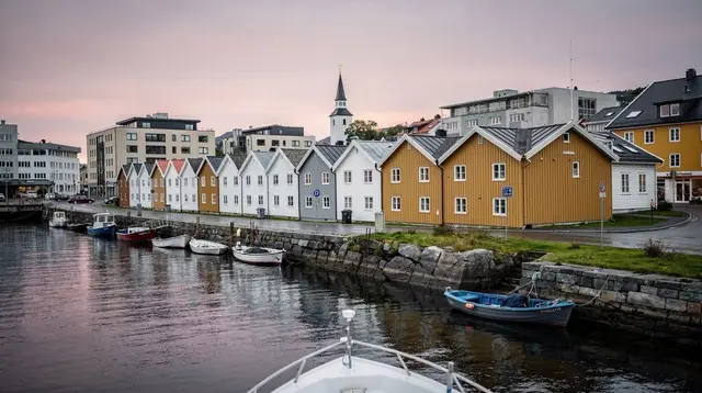
Cycling the Jæren Coast
Is cycling the Jæren coast a good idea if you don't want steep trails?
Yes. Jæren is flat, low-lying farmland and dune coastline southwest of Stavanger, with none of the elevation gain found on Lysefjord hikes. Marked coastal roads and cycle paths link beaches like Orre, Borestranden and Solastranden with only gentle grades, making it one of the easiest ways to spend a day outdoors in the region.
A flat coast where the Rogaland relief runs out
Most of what pulls visitors to Rogaland is vertical. The Lysefjord is defined by walls over a kilometre high, Preikestolen is a plateau reached by 350 m of climbing, and Kjeragbolten adds chained sections above a sheer drop. Cycling the Jæren coast is the opposite kind of day. Southwest of Stavanger and Sandnes, the land flattens into farmland, dunes and long sandy beaches, a landscape more like parts of Denmark or the Netherlands than the fjord country most people picture when they think of Norway. There is no comparable elevation gain anywhere along this stretch, and that single fact is what makes it worth a page of its own.
This guide treats cycling as a way of moving through Jæren, not as a substitute for the day-trip planning already covered elsewhere on this site. For opening hours, parking at individual beaches, and which stops suit which interests, the Jæren beaches day trip is the right starting point. What follows here is specific to doing that trip, or something like it, on two wheels.
What “flat” actually means on this coast
Jæren sits at or near sea level for almost its entire length. The terrain is a mix of arable fields, low dunes, and grazing land running down to the shoreline, with the sandy beaches themselves — Orre, Borestranden, Solastranden, Kvassheim and Obrestad — sitting right at the water’s edge rather than behind cliffs or headlands. Roads and cycle paths follow this same gentle profile. There are short rises near some of the dune systems and around the inland town of Bryne, but nothing that requires low gears or a rest stop to recover from, and nothing resembling a mountain pass.
This matters because it changes who the ride is realistically for. A visitor who has decided the Preikestolen trail or a Kjerag hike is more than they want to take on physically can still spend a full, satisfying day outdoors here. So can families cycling at a child’s pace, or anyone recovering from a long flight who wants movement without exertion. The appeal of Jæren by bike is not scenery that outshines the fjord — it does not try to compete with the Lysefjord’s scale — but an honest, low-effort day that still covers real distance and real coastline.
Routes along the coast
There is no single official cycling route number covering all of Jæren, and conditions on smaller farm roads change with the seasons, so treat the distances below as planning estimates rather than a fixed itinerary. They are built around the same stops used in the general Jæren beaches day trip.
| Segment | Approximate distance | Character |
|---|---|---|
| Sola / Solastranden area | 5-10 km loop | Coastal path close to the airport, flattest section, good for a short outing |
| Solastranden to Orre | 15-20 km one way | Farmland roads and coastal path, the core of a full-day ride |
| Orre to Kvassheim | 10-15 km one way | Dune and beach-adjacent roads, quieter traffic |
| Kvassheim to Obrestad | 8-12 km one way | Lighthouse coastline, exposed to wind off the sea |
| Inland detour via Bryne | 10-15 km added | Market town stop, flat throughout |
Add these together and a rider covering Solastranden to Obrestad and back in a single day is looking at somewhere in the range of 60-80 km, almost entirely flat. That is a serious distance for a casual cyclist, so most visitors either pick one or two segments rather than the whole coast, or split the ride using public transport at one end. None of this changes the basic fact that stands in contrast to the Lysefjord side of the region: the difficulty here scales with distance, not with gradient.
Wind is a bigger factor than hills on this coast. Jæren is exposed to weather coming straight off the North Sea, and a headwind on an otherwise flat road can slow a rider more than a modest climb would. Checking the forecast for wind direction, not just rain, is worth doing the night before.
Getting to the coast, and getting around once there
Sola sits close to the northern end of this stretch, near the airport, which makes it a natural starting point for a ride heading south toward Orre and beyond. From central Stavanger or Sandnes, the practical options are to cycle out on the connecting roads and cycle paths, to bring a bike by car and start from a coastal parking area, or to use local Kolumbus buses for part of the journey and cycle the rest. None of these choices require the kind of planning that a Lysebotn road closure or a Preikestolen weather check demands — the logistics here are closer to any ordinary coastal cycling day than to a mountain excursion.
For anyone without their own bike, rental points operate in and around Stavanger and Sandnes, though availability, bike type and pricing vary by season and by operator, so it is worth confirming locally rather than assuming a fixed cost. A standard hybrid or road-oriented bike is sufficient for every segment described above; there is no stretch here that calls for mountain-bike gearing or suspension. For general questions about moving around the wider area without a car, the do you need a car in Stavanger guide covers that ground in more depth.
If you would rather not pedal the whole day
Cycling suits people who want distance and open air without climbing, but it is not the only way to spend a day on this side of Rogaland, and it pairs naturally with other low-effort options. A private road trip along the coast covers similar ground from a car seat, with stops at panoramic viewpoints along the way — useful for a mixed group where not everyone wants to cycle the full distance.
a private coastal road trip that takes in panoramic viewpoints along this same stretchFor visitors who want some elevation without committing to Preikestolen or Kjerag, a short guided hike closer to Sandnes offers a middle ground between the flat coast and the fjord’s serious trails.
a guided hike up Dalsnuten near Sandnes for those who want a modest climb rather than none at allFamilies travelling with children who find a full day of cycling too long sometimes prefer a fixed-site activity instead. A net-and-obstacle adventure park near Stavanger is one option that keeps the day active without distance to cover.
an entry ticket to a net and obstacle adventure park in Stavanger as a shorter alternativeWhy the Lysefjord side is not part of this ride
It is worth being direct about a mistake that is easy to make when planning a Rogaland trip around cycling: the roads toward the Lysefjord and down to Lysebotn are not a version of the same activity with more scenery. The Lysebotn road is narrow, built around a series of hairpin turns cut into a mountainside, and carries car and coach traffic on a surface with limited passing room. It is closed by snow for part of the year and demands full attention from drivers, let alone cyclists sharing the same lane on a climb of that gradient. None of the conditions that make Jæren’s roads manageable — flat ground, wide verges, light gradients — apply there.
The two sides of Rogaland covered by this site are genuinely different activities wearing the same regional label. Jæren is a coastal cycling and beach-walking landscape. The Lysefjord corridor, including Preikestolen, Kjeragbolten and the Lysebotn road itself, is a hiking and boat-viewing landscape, best covered on foot, by boat, or as a passenger in a car rather than at the front of a bicycle.
If steep switchbacks and fjord views by road are still part of the plan, the Lysebotn road opening and closing dates guide explains when that route is even open, and it is a driving guide, not a cycling one. Anyone wanting a boat’s-eye view of that same fjord instead of a road trip can look at a RIB tour on the water.
a RIB boat tour into the Lysefjord for those who want that landscape from the water instead of the roadWhen to go
Because there is no snow-dependent access and no chained trail section to worry about, Jæren is workable across a longer stretch of the year than the Lysefjord hikes. Roughly May through September gives the most daylight and the driest paths, and is the period when most visitors combine cycling with beach time at Orre or Solastranden.
Outside that window the coast is still rideable — the terrain itself does not close the way the Lysebotn road does in winter — but shorter daylight, colder wind off the sea, and wetter ground make it a less comfortable outing. Anyone building a longer stay around both sides of the region can compare seasons more broadly using the best time to visit Stavanger, month by month guide, which covers Jæren and the Lysefjord side together.
Cycling the Jæren coast: practical questions
How hard is cycling on the Jæren coast compared to hiking near Lysefjord?
Much easier. Jæren stays close to sea level throughout, with rolling farmland and dunes rather than mountains. There is no equivalent to the 350 m of climbing on the Preikestolen trail or the chained sections on the Kjeragbolten route.
Can I cycle from Stavanger to the Jæren beaches?
Yes. Several routes connect Stavanger and Sandnes to the Jæren coast, mostly on quiet roads and dedicated cycle paths. Nearer beaches such as Solastranden are manageable in a couple of hours at an easy pace, while reaching Orre or further south makes for a fuller day.
Do I need a mountain bike for Jæren?
No. A standard hybrid or road-style bike is enough for the coastal roads and packed paths here. A mountain bike adds nothing, since there is no rough or steep terrain to justify one.
Can I combine cycling with the Jæren beaches day trip?
Yes. Cycling is simply one way to cover the ground described in the general Jæren beaches day trip. Use that guide for opening hours, parking, and which beaches suit which interests, and treat this page as the transport method layered on top of it.
Is it possible to cycle on the roads toward Lysefjord or Lysebotn instead?
No, and it is not recommended. The Lysebotn road is narrow, steep, and built around hairpin turns with car and coach traffic, and it is closed by snow for part of the year. It has none of the width, gradient, or traffic conditions that make Jæren’s roads workable by bike.
What time of year is best for cycling Jæren?
Roughly May through September gives the longest daylight and driest ground. The flat terrain keeps the route rideable outside a heavy storm at almost any time of year, unlike the mountain trails around the Lysefjord, which depend far more on season.
Are there bike rental options in the Stavanger area?
Rental points exist in Stavanger and Sandnes, but availability and pricing change season to season, so it is worth checking locally rather than assuming a fixed rate or guaranteed stock.
Should first-time visitors choose cycling or a guided driving tour of the coast?
It depends on appetite for physical effort and time available. Cycling suits visitors who want to set their own pace and stop wherever they like along the beaches; a guided driving tour covers more ground in less time and suits groups where not everyone wants to ride the full distance.
a scenic fjord cruise toward Lysefjorden and Preikestolen for the day the itinerary turns back toward the fjord side of the regiontours.cycling
Verified deep-linked GetYourGuide tours. Book through these links and we earn a small commission at no cost to you.
GetYourGuide does not provide a product photo for this activity — the image shows the meeting point, photographed by us.