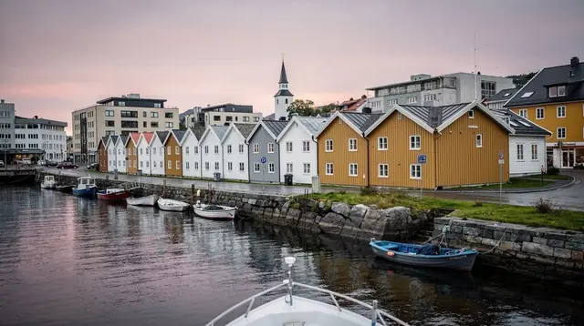
Four Days with a Car in Ryfylke
Four days with a car changes what a Rogaland trip can be. Without one, Preikestolen and a Lysefjord cruise are the whole story, because everything else sits past the reach of a shuttle bus or a ferry timetable. With a car, the third and fourth days open onto Frafjord’s Månafossen waterfall and the inner Ryfylke fjords through the Ryfylketunnelen — a 14.3 km subsea tunnel that drops to around 292 m below sea level, the longest and deepest road tunnel of its kind anywhere.
None of that appears on a bus-and-boat itinerary. It’s also worth saying plainly what this route does not include: Kjeragbolten. Reaching it means driving the full length of the Lysebotn road, a serious day on its own, and four days doesn’t leave room for that on top of everything else here. If Kjerag is the priority, the five-day itinerary is built around it instead.
Why a car, and what it costs you in return
Renting a car for this loop buys access, not comfort. Ryfylke’s roads follow the shape of the fjords rather than cutting through them, so distances that look short on a map take real time — a 40 km stretch along an inlet can run close to an hour with the turns, the occasional single-lane bridge, and slower traffic behind a caravan or a tractor. The itinerary below assumes that pace deliberately. Trying to compress it into less driving time is the single most common way this trip goes wrong: travellers plan by straight-line distance, then arrive at Månafossen with an hour of daylight left instead of an afternoon.
The upside is proportional. A car turns /destinations/frafjord/ and /destinations/manafossen/ from names on a map into an actual stop, and it makes the drive through /destinations/ryfylke/ — past places like /destinations/gloppedalsura/ and /destinations/byrkjedal/ — part of the trip rather than something skipped entirely.
Day 1 — Stavanger city, then the road toward Lysefjord
Spend the morning in /destinations/stavanger/ itself before the driving starts. Walk the cobbled lanes of /destinations/gamle-stavanger/, around 170 white wooden houses from the 18th and 19th centuries and the largest concentration of preserved wooden houses in Northern Europe — still a lived-in neighbourhood, not a museum set piece. A self-guided route through it takes an hour or two; see the walking guide at /guides/gamle-stavanger-self-guided-walk/ if you want a structured path rather than wandering. From there it’s a short walk to Stavanger Cathedral, consecrated around 1125 and the only medieval cathedral in Norway still standing and in use without a major rebuild, and to the colourful facades of Øvre Holmegate nearby.
By early afternoon, pick up the rental car and head out of the city toward /destinations/lysefjord/. The drive to the /destinations/forsand/ side of the fjord, where most Preikestolen trailheads and boat departures are based, takes roughly 45 minutes to an hour depending on traffic through /destinations/jorpeland/. Use the rest of the afternoon to settle in near Forsand or Preikestolen fjellstue rather than pushing on — Day 2 starts early, and arriving the evening before means you’re not rushing a hike start after a long morning drive.
Overnight: Forsand or the Preikestolen fjellstue area.
Day 2 — Preikestolen, then the fjord from the water
This is the day the whole trip is built around, so give it the whole day. The standard Preikestolen trail is about 8 km round trip with roughly 350 m of elevation gain, typically 4 to 5 hours including time on the plateau — real, uneven terrain rather than a paved path, so start early to beat both the midday crowds and any afternoon weather change. Parking at the trailhead is paid; the trail and the plateau itself are free. Full timing and crowd-avoidance detail is in /guides/preikestolen-how-long-does-it-take/.
If you’d rather not manage the trail solo, a guided option covers both the hike and a boat leg on the same outing: a combined Lysefjorden cruise and Preikestolen hike pairs the climb with a look at the fjord from the water afterward, which is a efficient way to use a single day if you’re not driving yourself to the trailhead. For hikers who want local knowledge on the trail itself rather than a fixed group schedule, a small-group guided hike around Preikestolen is worth booking ahead in peak season, when trailhead parking fills before mid-morning.
Back at the car by mid-afternoon, there’s time for a shorter Lysefjord boat trip if you skipped the combined option, or simply to rest before tomorrow’s longer drive. Overnight again near Forsand or Jørpeland — staying on this side of the fjord keeps you close to the Ryfylketunnelen turnoff for Day 3.
Day 3 — Frafjord, Månafossen, and into inner Ryfylke
This is the day a car makes possible on its own. From Forsand, drive north and inland toward /destinations/frafjord/ — allow a good hour and a half for a route that measures shorter on a map, since it follows fjord arms rather than cutting across them. Frafjord sits below /destinations/manafossen/, a waterfall around 92 m high, the tallest in Rogaland, reached by a moderate trail through the valley. It’s a different register from Preikestolen: no crowds, no queue, just the walk in and the water. Full trail notes and season advice are at /guides/manafossen-waterfall-hike-guide/.
Two ways to spend the middle of the day here, depending on what you want from it. If the waterfall and a scramble suit you better than a paddle, a guided Månafossen waterfall and via ferrata bouldering outing combines the hike with some light climbing on secured routes near the falls. If you’d rather be on the water, a guided kayak or stand-up paddle tour on Frafjord covers the fjord itself at a slower pace, a good match for a day that’s otherwise spent driving.
By early afternoon, head deeper into /destinations/ryfylke/ toward the Ryfylketunnelen — opened in 2019, about 14.3 km long, dropping to around 292 m below sea level, the longest and deepest subsea road tunnel in the world. It’s part of the Ryfast project that connects Stavanger to Ryfylke without a ferry, and driving it is worth doing for its own sake, not just as a way through. On the far side, the roads past /destinations/gloppedalsura/ and /destinations/byrkjedal/ run through some of the most dramatic scenery in the region — steep valley walls, scattered farms, very little traffic.
Overnight: somewhere in inner Ryfylke, near Byrkjedal or Hunnedalen, to break up the driving before the return leg.
Day 4 — Inner Ryfylke and the road back to Stavanger
Use the morning to see more of the inland Ryfylke landscape before turning back — this is the part of the trip that never appears on a bus itinerary, and it’s worth not rushing through it just because it’s the last day. A short walk or a slow drive through the valleys near Byrkjedal and Hunnedalen makes a quieter contrast to the last two days’ bigger sights.
By early afternoon, retrace the route back through the Ryfylketunnelen toward Stavanger. Depending on your flight or ferry time, there’s usually room for one more stop close to the city — Sverd i Fjell at Hafrsfjord, three bronze swords roughly 10 m tall planted in 1983 to mark the Battle of Hafrsfjord in 872, is a five-minute detour from the main road into town and needs no more than twenty minutes on foot.
Return the car in Stavanger by late afternoon or evening, depending on your departure.
Driving distances and times, day by day
| Day | Route | Approximate driving time |
|---|---|---|
| 1 | Stavanger city to Forsand / Preikestolen area | 45–60 minutes |
| 2 | Local only (trailhead, short fjord transfers) | Under 30 minutes |
| 3 | Forsand to Frafjord, then Frafjord to inner Ryfylke via the Ryfylketunnelen | 2.5–3 hours combined, spread across the day |
| 4 | Inner Ryfylke back to Stavanger via the Ryfylketunnelen | 1.5–2 hours |
These are driving times only, not including stops — and they run long relative to the map distances, which is the point worth planning around rather than discovering on the road.
What this itinerary leaves out on purpose
Kjeragbolten is the obvious omission, and it’s deliberate rather than an oversight. The boulder itself sits at around 984 m, reached by a 10 to 12 km round-trip trail with three sections secured by chains — six to eight hours for the hike alone, before counting the drive down the Lysebotn road to the trailhead at Øygardstølen. That road closes in winter and, even in season, is enough of a commitment that pairing it with anything else on the same day isn’t realistic.
Trying to squeeze it into this four-day route means cutting Frafjord, Månafossen or a full Ryfylke day to make room, which defeats the point of having a car in the first place. If Kjerag matters more to you than the inner fjords, the five-day itinerary at /itineraries/five-days-kjerag-and-jaeren/ builds the extra day in properly, and the road’s opening dates are worth checking beforehand at /guides/lysebotn-road-opening-closing-dates/.
FAQ: Planning a Four-Day Ryfylke Road Trip
Can you fit Kjeragbolten into four days if you have a car?
Not comfortably. The Lysebotn road that leads to Kjerag’s trailhead is a full day round trip on its own, on top of the driving this itinerary already does. Adding it means dropping Frafjord, Månafossen or a full day in Ryfylke — see the five-day itinerary if Kjeragbolten is the priority.
Do you need a car for this itinerary, or could you rent one for just part of it?
You need it from Day 2 onward. Stavanger’s centre and Preikestolen are both reachable by bus or boat, but Frafjord, Månafossen and the inner Ryfylke roads through the Ryfylketunnelen have no public transport serving them.
How much driving is actually involved in four days?
More than the map suggests. Fjord roads in Ryfylke wind around inlets and climb over passes, so a 40 km stretch can take close to an hour. Budget driving time generously and avoid stacking a long hike and a long drive on the same day.
Is Månafossen worth the detour if you’ve already seen Preikestolen and Lysefjord?
Yes — it’s a different kind of place. Månafossen is a 92 m waterfall above Frafjord reached on foot through a narrow valley, with none of the crowds or infrastructure of Preikestolen, and it’s the kind of stop a shuttle-based visit to Stavanger simply skips.
What is the Ryfylketunnelen and why does it matter for this route?
It’s a 14.3 km subsea road tunnel opened in 2019, dropping to about 292 m below sea level — the longest and deepest of its kind in the world. It replaces a ferry crossing and is what makes a same-day loop between Stavanger and inner Ryfylke realistic with a car.
Should you book the Lysefjord boat trip or drive to Preikestolen and hike?
They answer different questions. The hike gets you onto the plateau itself; a boat trip shows you the fjord walls and Kjerag from the water without the climb. With a car and four days, most travellers do the hike on Day 2 and save the water view for a shorter, easier morning.
Is this itinerary manageable without much hiking experience?
The Preikestolen trail is the main physical demand — about 8 km round trip on uneven ground, manageable for a reasonably fit walker in good shoes. The rest of the route is driving and short walks, so the itinerary as a whole is more moderate than the Preikestolen day alone suggests.
tours.4 days
Verified deep-linked GetYourGuide tours. Book through these links and we earn a small commission at no cost to you.
GetYourGuide does not provide a product photo for this activity — the image shows the meeting point, photographed by us.